Saturday, October 28, 2017

On to Florida


Arriving in Florida

This section was supposed to be the shortest, time wise. Our plan was to leave Charleston on the outgoing tide and make the overnight crossing in the ocean to Fernandina Beach. Leaving in the morning, we’d arrive in Florida by the next afternoon. The forecast, which sounded favorable to us, called for 10-15 kt NE winds, shifting to the east with 2-4 foot waves. And so as the tide fell, we motored into a northeast wind, past Ft. Sumter and out into the Atlantic. And into trouble.

Motoring out past Ft. Sumter


It was not really trouble, as far as Luna was concerned. The passing cold front had left the seas confused and very choppy and larger than advertised (of course). The wind blew in a quadrant from north to east northeast. And, as the coast fell off to the west, our course took us nearly directly downwind.

This combination made for an uncomfortable day. The disordered waves tended to turn Luna to the west, gybing the jib and making her roll. The first mate was sickened by the motion. Steering required constant vigilance. And while I manned the helm, the commander looked at the electronic chart for inlets we could safely enter if we changed our plan.

We sailed on for a while. The mate got more accustomed to the Luna’s motion and, with assurances that the conditions were OK for Luna, less fearful. We took down the jib and motor-sailed with reefed main and preventer. This combination steadied us somewhat. As we looked ahead, however, we couldn’t imagine keeping this up all night in the dark, when we would be unable to see the sail and waves. Moreover, we wouldn’t be able to use the autopilot, which would have been overwhelmed by all the turbulence.


To the west was St. Helena’s Sound, an inlet with a deep, buoyed channel, but with reports of sandy shoaling with the recent storms. On the charts, we saw an anchorage in a quiet creek within the shore. We decided to make for the inlet.

Our course had taken us far enough out to sea that it took a couple of hours to reach the inlet, and by then the sun was going down. Under a spectacular sunset and a crescent moon, we followed the buoys as long as we could see them. Then, as darkness fell, we relied on our electronic charts and depth-finder to stay in the deeper water and had no trouble with shoals. We all were relieved when we reached the shelter of the shore and the calm water of Jenkin’s Creek, where we anchored for the night.

Back on the Waterway, we read the daily weather report only to find that more heavy weather, a tropical storm heading inland from the Gulf of Mexico, was to reach us in two days. So we made a short course to the friendly marina at Port Royal, just below Beaufort (that’s Beeyoufort), SC, for two nights. They lent us their courtesy car, and we explored the little town in the rainy afternoon.

Beaufort, and the area around it, has a fascinating history. Predating Jamestown, it was one of the earliest colonial settlements. Spanish, French, and English explorers left their marks here. Under Spanish control, it became the capital of Florida until, facing pressure from the English, the Spaniards moved the capital to St. Augustine.

At the time of the American Revolution, the population of Beaufort was 9,000, which included 8,000 slaves. The area prospered growing rice and indigo in the marshlands, and logging the live oak trees for ship-building.

After the Revolution, the Tories relocated to the Bahamas with their slaves, but sent cotton seeds back to their former neighbors. This crop, highly prized Sea Island cotton, replaced rice as a staple of the economy.

After the attack on Ft. Sumter, the Union army occupied Hilton Head Island, and the interesting part of the local history began. Under Union control, all slaves were freed, and escaped slaves found safe harbor here. The Federal government made efforts at education and economic development. Former slaves became their own masters on the sea islands in what is now Beaufort County, and, under Reconstruction, the area had a majority black population. The Gullah culture, a Creole mixture of American and African influences and language, is celebrated in local museums.

The economy grew with shellfish-packing plants, lumbering, and a phosphate-mining operation. Then came the end of Reconstruction. The party of Lincoln gave way to the party of Jim Crow, a hurricane decimated the local economy, and a fire destroyed the phosphate plant. As many blacks joined the great migration to find work in northern states, Beaufort became an area dominated by whites once again.

With this transition came the collapse of the shellfish industry as pollution took away the once prized Daufuskie Island oysters. The local economy was rescued when the Marines established a training base and an air station on Parris Island. This wartime boost continued through the Korean and Viet Nam wars and prevails today.

Now the area prospers from vacation homeowners as well. Traveling past Beaufort around Hilton Head and Daufuskie Island, we gape at the large homes and boats. One of the historic plaques at the Beaufort waterfront notes that the surrounding county has the second highest per capita income of any in South Carolina. However, where there are no houses, the salt marshes with their tall grass and hidden creeks winding in from the river mark a desolate and beautiful section of the Waterway, and I am glad we were forced to make this detour.

If, seeing the local fishermen in their small boats coursing through the seemingly featureless salt marshes and tidal creeks, one thinks of Luke Wingo, the Prince of Tides, it is because this is the country of Pat Conroy. He graduated from Beaufort High School, and after college, he returned to the area to teach and write until his death last year. The Water is Wide, his book based on his experiences teaching on Daufuskie Island exposed the institutional racism of the Jim Crow era and celebrated the enduring power of education guided by a committed and loving teacher. His tenure, however, lasted but a year, after which he was fired for his unconventional methods and refusal to resort to corporal punishment in his classroom. There is a Pat Conroy literary festival going on, but we arrive a few hours too late to catch stage productions of The Color Purple and Conrack (the Daufuskie Island students’ name for Mr. Conroy).

We’ve learned that Beaufort was the first to build an integrated high school in the early 1970’s and prides itself on having left the legacy of the old South behind. It’s a richly complicated area that moved from slavery to control by the black Gullah culture, back to white dominance, to prosperity in the wartime economy, to the end of the “separate but equal” schools, to a mecca for second homeowners. And, after it all, one may wonder how these princes and princesses of tides voted in the last presidential election. It turns out the county favored the Republican alternative by 55-41 percent, exactly the same split as the state of South Carolina as a whole.

The marina was generous with its courtesy car, but within easy walking distance were several of the shopping staples for the nautical cruiser. We visited the Mexican restaurant, and the next day, I walked to Advance Auto to dump some used motor oil. A little further was the supermarket for a few things, and I passed West Marine. Passing West Marine always produces some anxiety: the thing you don’t buy is the very next thing that will break as you sail away. I was able to control myself, and on the way back, found a little stand selling fresh seafood where I bought a couple of red snapper filets and a pound of fresh crabmeat.
Luna tied to the face dock at Port Royal


We stayed the second day and waited for the storm to pass. We were fine with the rain and thunder, but the wind created huge waves on the river that flowed right by the face dock where we were tied. So we spent a miserable couple of hours banging against our fenders that protected us from the dock. But this too passed, the sun came out, and we had a lovely dinner of fresh snapper, wrapped in parchment with a little Caribbean seasoning, lemon slices, and butter, and baked in a 400 degree oven for 15 minutes. To celebrate the passing of the storm and the end of the pounding, we brought out a bottle of nice red wine we had been carrying.

The marina offered three nights for the price of two, but with the storm past us, we left the next morning, riding the tide through the bottom of South Carolina into Georgia. We passed the Savannah River and made a few more miles before stopping at the marina on Isle of Hope. Here we tied up under much calmer circumstances to the face dock between the megayacht and the 50-foot sailboat.

The sailor came over to greet us. He told us he had been sailing north from Fernandina Beach to Norfolk, but the wind and waves were so great that he and his wife couldn’t stand the pounding and came into shore. We felt vindicated for having changed our course a few days earlier.

The Commander and I walked around the streets on the Isle of Hope. It’s a lovely place. Small houses with lots of people out and about in the late afternoon—people walking dogs, kids on bikes, adults with kids. This is such a different feeling from the large homes along the Waterway further north where we rarely saw any people outside. As we walked, we marveled at the huge live oaks draped with Spanish moss, aged survivors of the wooden ship-building days that shaded the houses, streets, and yards.

Spanish moss drapes the ancient Live Oaks


We could have stayed there, but we were off early the next morning. Our thought was that, with the front’s passing, perhaps we could go out at another inlet to Fernandina, but once again, the weather looked like more of the same north winds and big seas.

But the wind allowed us to put out the genoa, and we motor-sailed through the crooked creeks and rivers, around the marshes, and through the sounds of the Georgia sea islands. I remembered times flying north from Florida, when I had a window seat and could look down and see a twisted mess of water and land. And this is what we were sailing through. The rivers were deep. We sailed three miles to make two as the crow flies. The views were spectacular. We were mostly alone in a fantastic remote world of water and grass, and occasionally the wider rivers were joined to the sky by a thin horizon of green marsh grass.

At one point, the Commander looked back and saw a buoy following us. Apparently we had run over something, most likely a crab trap. She turned, and I was able to grab the rope with our boat hook. It led to a styrofoam box, and on the other end, trapped by Luna’s keel, was a plastic parachute and the remnants of a rubber balloon. Directions and a mailing envelope fastened to the box told us how to send the weather sonde back to NOAA. Perhaps they flew this during the recent hurricanes.

We penetrated further into this lonely world. And the thought crossed my mind, “If something were to happen with Luna, it would probably be here, far from civilization.”

We motor-sailed on, and at one point, on a starboard tack, we heeled slightly to port. Heeling to port offers the opportunity to pump Luna’s bilge, which is very shallow because of her swing keel. The pump is on the port side, and when she heels that way, all the water goes there, and the pump can do its job. I turned on the pump, and reflexively, opened the hatch to look at the bilge.

Luna rarely collects much water down there, and imagine my surprise to find it full of water up to the cabin floor. Somehow, water is getting into the boat.

The role of the captain in these situations is to remain calm, assess the problem, and devise plans and contingencies to solve it. It can be a bit like a chess game to think two or three moves ahead with real consequences. I closed the hatch and came up to the cockpit, where I announced, “There is a problem with water getting into the bilge. Don’t worry, everything is fine.”

“That’s good,” said the Commander at the wheel. “But how come you’re wearing your life jacket and climbing out onto the swim ladder?”


That didn’t actually happen. I came up and said, “Water is getting into the bilge from somewhere. I’ve turned on the pump, but I have to climb down into the cockpit locker to have a look.” When the mate and I got all the stuff out of the locker and opened the hatch to the back of the engine, I expected to see a loose through-hull fitting or maybe a burst cooling hose. What I found was a pinhole in the heat exchanger and a spray of seawater soaking the area under the cockpit and draining into the bilge.

Luckily, we have an alternative means of propulsion, so at the expense of a little speed, we could turn off the engine. While the Commander sailed Luna through the Waterway, I thought of ways to fix the hole, or to reroute the cooling hoses to bypass the heat exchanger and run sea water directly through the engine. I discounted the idea of duct tape, useful in fixing nearly anything else. However, we did have a tube of quick setting epoxy among Luna’s tools. So I cleaned the area with lacquer thinner to remove any grease, mixed up some epoxy, and coated the area, trying to work the stuff into the small hole. We continued to sail for a few hours to give the glue plenty of time to cure.

We came out on Sapelo Sound, the wind in our face, and the tide running against us. We tried to tack upwind and up current, but it seemed we lost ground with each tack. The only way forward was to start the motor. If the patch failed, we’d just have to keep the bilge pump going. We held our breath, and I turned the key. We started against the tide. I looked down into the motor—no water. The fix held, and remains in place today, four days later. Hopefully it will hold until we get to Stuart, and I’ll replace the heat exchanger there. It must be corroded from the inside.

Meanwhile, we found another lovely secluded anchorage in the marshy low country, this time on the Crescent River. The next day, running at high tide, we passed the shoals at Jekyll Island to anchor off the northern end of Little Cumberland Island at Terrapin Cove in St. Andrew’s Sound. Here, the waterway is wide open, and at night we can see the lights of Brunswick to the north and the glow from Fernandina Beach in the south. And, aside from a few flashing buoys and the deserted beach that wraps around to the east and south, there is not much else. There is a watery world before us, and we have it all to ourselves. At least above the surface.

From there it’s a short hop (20 miles) to Fernandina Beach, so there is no rush to leave next morning. The Commander sleeps late and makes pancakes for us when she rises. The sun is warm. We have a brief swim and bathe in the salty water, rinsing off with the fresh water in the sun shower. Finally, we’re back on the magenta line, motor-sailing with the east wind to Fernandina Beach, where we pick up a mooring at the Municipal Marina. Florida at last!

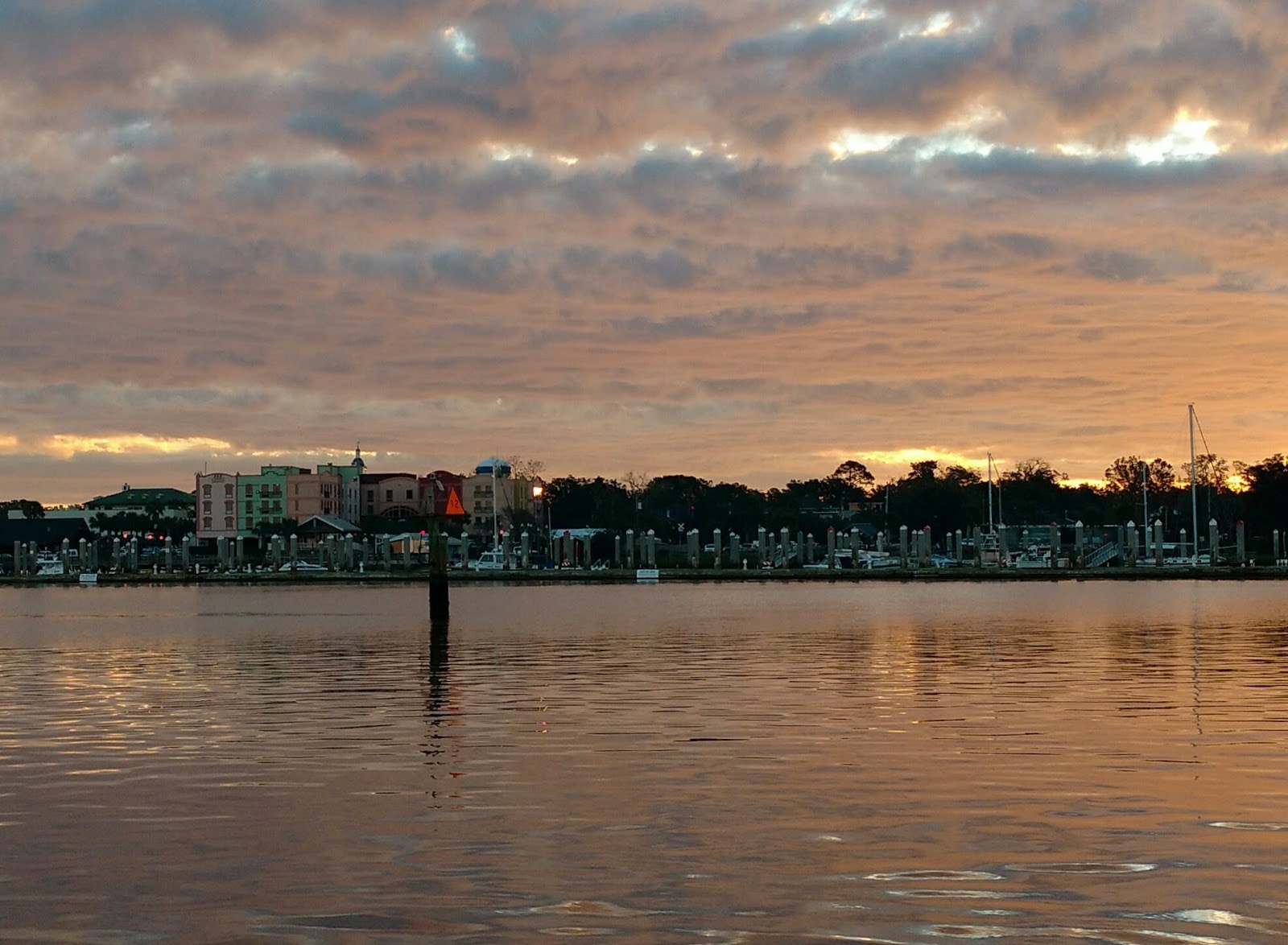
Sunrise in Fernandina


Friday, October 20, 2017

To Charleston

Through South Carolina

After a week in Wilmington we left the dock at the Carolina Beach State Park to continue the waterway down through South Carolina. Our departure was not without fanfare. We’d spent the week visiting my brother and sister-in-law and the Commander’s sister and brother-in-law. They all showed up at the dock, mimosas in hand (Note, alcohol is strictly prohibited in North Carolina state parks) for a below-decks toast to Luna’s continuing voyage. They all, minus Lisa, the Commander’s sister, who signed on to the next segment of the journey, helped push Luna from the dock, and we were seabound once again.

Toasting to a safe continuation of Luna's voyage

We timed our departure to reach the Cape Fear inlet at slack tide falling, so we had a nice ride down the Cape Fear River on the outgoing current. At the inlet, we turned south to continue in the waterway, past Southport and on to our first destination, an anchorage at Calabash Creek.

We didn’t know anything about this anchorage, but it was a reasonable (40 mile) distance and received good reviews on our crowd-sourced navigation program, Active Captain. The reviews proved  justified, as the anchorage was peaceful, lovely, and, as Luna was alone here, quite remote. A couple shrimp boats came by at night, heading out to sea. Calabash is the home of Jimmy Durante’s Mrs. Calabash, who operated a seafood restaurant. Since the 1930’s Calabash has been known for a style of cooking that involves frying fresh seafood. The Commander and I tried some on a road trip a few years ago. We’ve tasted better.

However, in honor of Calabash, I cooked up the trigger fish filets we brought with us from our favorite seafood shop in Carolina Beach. Dredged in flour and a beaten egg, then coated with panko breadcrumbs and fried in oil and butter, they made a delicious meal, better than we remembered in Calabash.

Once you get down through the development along the waterway in Myrtle Beach, South Carolina is an absolute delight. We loved it last time we cruised through, and it continues to charm us. Here, the waterway enters the Waccamaw River. The river is named after the Waccamaw people who lived between it and the PeeDee River to the south. Here they grew cotton and tobacco. They were nearly totally wiped out by the Spanish and English during the colonial period. I must have missed the T shirt that said, “I welcomed the explorers, and all I got was this measly river.”

If the river is any indication, the Waccamaw must have been a beautiful people, fortunate in their choice of a home. The waterway winds through forests and coastal lowlands. Abandoned rice fields line its bank in places. Finally, there are few if any houses here. The Waccamaw flows through the most remote part of the route.


A thunderstorm passed, ushering in a cold front that would bring cooler temperatures and a brisk north wind for the next few days. We anchored in a winding creek off the main waterway. We were the only ones we saw on Prince Creek.

Morning at anchor in Prince Creek


The next day took us further into the remote lowlands. The muted colors of green and yellowing deciduous trees, tan and green grasslands, brown tangled branches of the swampland, and the tannin-colored brown water delighted our eyes in every direction. The north wind allowed us to hoist the genoa and sail for much of the route down to another remote anchorage at Duck Island, a few miles south of Georgetown.

The creeks along this section are affected by changing currents, often swift, as the tide changes. We used two anchors, one on the bow and one on the stern, to limit Luna’s tendency to swing and either move too close to shore or turn with the wind and trap the anchor line around her keel.

After three days on the relatively quiet waterway, we entered civilization again on the way to Charleston. More boats, now, are heading south. There are a few sailboats, but still most are power boats.

There is an etiquette on the waterway when a faster power boat passes a slower vessel. The slower vessels slows to an idle, and the faster vessel also slows to pass. This minimizes the wake that would rock the slower boat. Usually, when the faster boat approaches, he calls ahead on the radio to announce his presence and his intention: “Luna, this is Large Power Yacht, and I’d like to pass you on your port.” We appreciate this courtesy, and call the passing vessel after they are by to thank them for passing us slowly.  And, as this section of the waterway is affected by shoaling, we may ask them to alert us to any skinny water up ahead. This has been very helpful to us at times.

Of course, there was a time when a large power yacht roared by, barely slowing down as we did and throwing up an enormous wake. Boats move along three axes. When they rotate around their transverse axis, they pitch. When they move about their longitudinal axis, they roll. And when they sway along their vertical axis, they yaw. As this inconsiderate lout passed, Luna pitched, rolled, and yawed, somewhat violently. “We should call him up and tell him how it’s done,” the Commander said.

But I was lost in another thought. “How are we going to make America great again,” I asked, “if the stronger or faster continually press their advantage against those who may be slower or weaker, but perhaps offering of other advantages in other ways?” Yet isn’t this the essence of the new ethic? Full speed ahead, take all you can get, and never mind your wake. And isn’t this what is being offered as the best America can give to its own people and to the rest of the world?

I am reminded that the Commander has banished from Luna forever any reference to him who will not be named here, so that will be the end of this particular discussion.

There are houses along this stretch, but they are not at all like those on the North Carolina waterway. Here, the houses blend into the trees. When painted, their colors are muted and natural, shades of gray or green that seem to grow out of the forests themselves. Not at all like the showy monoliths that are packed shoulder to shoulder on treeless slabs of ground further north, these houses evince an understated elegance and grace. We appreciated this ethic greatly.

The Commander picks up shells on the beach at Bull Island
 We spent the fourth night in Price Creek, a favorite anchorage we discovered on our last trip. Here is an inlet to the ocean. The creek is 20 feet deep, so we let out 140 feet of anchor rode, but it’s wide enough that even when we swung around, there was enough room that we would not wander too close to the banks. We took the dinghy down and motored to the beach, a wildlife preserve called Bull Island, admired the ocean and collected whelk shells. We marveled at the dolphins in the waters, particularly a juvenile who enjoyed jumping with the exuberance of one who has just learned to swim and is trying out his fins for the first time. He was airborne above the surface of the water several times until his mother appeared and herded him away from our dinghy.

The final day was a short ride to Charleston, just 19 miles to the St. Johns Yacht Basin on the Stono River, a little south of the city. The marinas in town were filled for the weekend, as boats came through on their way south. On the way I saw several flags displaying a palm tree and what appeared to be a crescent moon. Turns out this is the South Carolina state flag, which is also on their license plates.

Now this is interesting. Rather than a snake that says, “Don’t tread on me,” here is a tree inviting a hug. I learned that both these images, the palmetto and the crescent, were images from the American Revolution, made into a flag by Colonel William Moultrie in 1775. It was the first revolutionary flag. The palmetto was of use to colonial soldiers. Covered with sand, the palmetto trunks provided the breastworks that repelled British cannon balls. And the crescent (pointedly, not a moon)  was a breastplate worn on the uniforms of South Carolina militia. The background blue color of the flag was the color of those uniforms.

The South Carolina flag appears on the license plates


South Carolina played an important part in the war. In Charleston, colonials confiscated British tea, selling it later to raise funds for the revolution. The loyalists here allied with the British who intended to squeeze General Washington’s troops from the south. They were helped by escaped slaves, who were promised freedom by Britain. However, irregular fighters in the lowlands and creeks stymied the British and the loyalists, culminating at last in the British evacuation of Charles Town on December 14, 1782. This day is officially designated as South Carolina Independence Day, and the city was renamed Charleston to sound less British.

The loyalists, of course, evacuated to the Bahamas to settle with their slaves in the Abacos, but that is a story for later.

The point of all this is that it makes one wonder: “Wouldn’t it be interesting, and much less divisive for this country, if South Carolina and her sisters in the South were to commemorate the American Revolution rather than the Civil War?” Savannah manages to erect monuments to Revolutionary War heroes in its public squares, but it is a city quite unique in this respect. Of course, Savannah managed to sit out the Civil War. When General Sherman approached, a delegation met him and surrendered the city asking him to spare it from the flames. It is not written what they offered him in return.

The north winds are abating somewhat and as the front passes finally, will moderate and clock around to the east. It is Thursday, and by Saturday conditions offshore should allow us to reach south to Florida. In the meantime, we’ll do some restocking and enjoy some of the restaurants in Charleston.


Luna's wake sparkles in the sun in the Carolina lowlands


Sunday, October 8, 2017

North Carolina


North Carolina

The winds on the Chesapeake calmed down, and we were able to sail much of the way to Norfolk. Past the huge Navy ships in the Norfolk Naval Yards, past the container ships being unloaded at the quays by the Star Wars cranes, we anchored off the Portsmouth Naval Hospital. Aside from two unmanned boats in the anchorage, we had the place to ourselves. We wondered: “Where are all the sailboats going south like Luna?” The predominate species so far has been huge motor yachts.

Star Wars cranes unload shipping containers in Norfolk, VA


We left the anchorage early and passed Mile 0 of the Intracoastal Waterway. From here, on our GPS (and everyone else’s), our route is marked by magenta line that extends from here all the way to the Florida Keys. At this point, one can choose between two alternatives. The Dismal Swamp exits from the main channel a few miles down. Continuing straight on is the Virginia Cut. The former route has been closed since Hurricane Matthew passed through in 2016. Reports are it will open at the end of October. We continued straight into the wider and more heavily travelled Virginia Cut.

There is one lock on the system, and we passed through easily. We fell in line with a U.S. Army Corps of Engineers dredger and a larger sailboat, Second Option. We made a little parade and followed them all the way south to Coinjock, about 12 miles shy of the Albemarle Sound. On the way, the route passed through the Currituck Sound, which was open and fairly rough with the 15 kt north wind that was blowing. We took advantage of this to put out our jib and motor sailed through at a good (for us) speed of 7 kts.

Our companions stopped at the marina in Coinjock for the night, but we continued on to an anchorage we had identified on the chart. When we arrived, we found it fairly wide open, and the north wind created rough and somewhat blustery conditions, so we turned back and motored back to the marina. When we checked in, I thanked the owner for not saying, “I told you so.”

Coinjock Marina consists of a very long face dock, a restaurant and store, and not much else. The friendly dock hand tied us in the line of boats that had very little space between them. Aside from Second Option, we were the only sailboat there. The rest were (you guessed it) enormous motor yachts. One very sleek number from as far away as the BVI seemed to have no one on her. We guessed they sped up here when the threat of hurricane approached and sought shelter at Coinjock.

I asked a captain of one of the other motor yachts, Knucklehead (really??), why we were seeing so many large yachts on this trip. He said that the conditions for going outside (taking the ocean route) have been very unfavorable, so he was taking the inside route. This makes sense. I imagine a line of huge motor yachts going out in the ocean straight to Florida. Much more efficient, but then who would there be to see them?

One such boat pulled in, and the captain put 1,200 gallons of diesel fuel into the tank. More than we use to heat our house in a cold Vermont winter. The Commander and I are wondering if the number of these behemoths is a manifestation of the income equality that seems to be getting worse in this country. And we think, “And you’re going to cut taxes for these?”

The Albemarle Sound has earned a nasty reputation for rough conditions when it is windy, and we stay a second day to avoid 20-25 kt winds the next day. The day after calls for 10-15 kt winds with 2 foot waves, and we spend a delightful day sailing downwind across the bay to the Alligator River 14 miles away on the opposite side.

We have been running with a preventer on the boom. This is a line attached to the toe rail on the leeward side with a snap shackle, which goes up to a snatch block on the boom, back to the toe rail with another snatch block, to a winch in the cockpit. When the wind shifts or the mainsail gets back winded, the preventer keeps the boom from gybing. The arrangement makes sailing down wind so much easier and more pleasant, I wouldn’t be without one now. We can run wing on wing without worrying about the mainsail.

The wind followed us up the wide Alligator River, but soon the waterway became twisting and narrow and we doused sail and motored on. Off the main channel, which continues south along a dug canal to the Pungo River, we followed the river around a couple bends to a very quiet and fairly well protected anchorage for the night. Here the water is faintly brackish and tea brown, the latter from the tannins in the scrub pines, the yellowing marsh grass, and the few reddening deciduous trees that grow on the coastal lowlands through which the river and its feeder creeks flow.

An Alligator River anchorage all to ourselves.


We are in a beautifully serene spot, no one else in sight, alone with the crab pots. The sun sets over the marshes. The waxing moon rises.  We bathe in the soft water of the fairly warm river. We don’t want to get too far away from Luna, the thought occurring to both of us simultaneously: “Do you think there are alligators in the Alligator River?”

The next day, we motor and sail to Belhaven, a small town on the Pungo. Large yachts from Coinjock pass us. Our favorite, whom we’ve seen off and on since Norfolk, is Starlight, a racing green and mahogany 125-foot ship from Palm Beach, FL. She passes us slowly and courteously, and the captain from the wheelhouse gives a hearty wave. Luna and Starlight. We like that.

Starlight pulls into the Marina, but we anchor in the harbor near the public dinghy dock. We hoist the dinghy off the foredeck and take a tour of the town. Behaven is one of those Carolina waterway towns that prospered in the 19th century by lumbering the local pines and by fishing. A railroad spur connected it to trading centers up north. The town calls itself the birth place of the Intracoastal Waterway. This is because the final link of the route was completed in 1928—the interminably straight and boring Pungo-Alligator River Canal, which we just passed. The completion of the waterway allowed barges to take products directly to Norfolk, thence Baltimore and New York or overseas. Belhaven must have been doing pretty well. Then, of course, the interstate highway system changed all that.

There are large houses along the river and a couple of marinas, but the town does not seem to be thriving. Most of the shops only open on weekends, clearly catering to the summer yachting trade. During the week, only one local restaurant is open at a time because there is not enough business for all.  As in other marinas we’ve passed, most of the slips are empty. I believe many owners pulled their boats out before the hurricanes threatened, but it gives a desolate look.

Many of the large houses are for sale. Walk to the further reaches of the main street, and it’s clear there is a divide in the town along economic and racial lines. We’re heading for the post office, which is a mile out of the center of town, across the divide. People here are friendly, waving even from their cars. One man stops and offers us a ride. Another offers directions when we ask and wants to be sure we’ve found it when we pass him on the way back.

Belhaven’s one claim to fame arose from this side of the divide. Eva Narcissus Boyd was born here in 1943. She moved to Brooklyn and found a job as a housecleaner and nanny for Carole King. The latter, enamored of Eva’s voice and way of dancing, wrote The LocoMotion  for her, and Eva recorded this as Little Eva. Eva died in 2003 and is buried in the cemetery here, under the gravestone with the locomotive.

The next day presented one of those opportunities, mentioned earlier, to test our goal directedness. We left the Pungo River as it joined the Pamlico River. From there, the magenta line coursed through a narrow passage to the Neuse River where the town of Oriental is our destination for tonight. However, the Pamlico River enters Pamlico sound, another of those long, narrow, shallow bodies of water separating Carolina’s barrier islands, the Outer Banks, from the mainland, or the inner banks as they are called. There is a 15 kt northeast wind, and we can reach the Neuse River by going the long way through the sound, a course that will add about 15 miles to our day. When the wind blows over these shallow sounds, it kicks up a pretty rough chop.

So, do we follow our goal and motor the most direct route to Oriental. Or do we go the long way and have a fairly exciting sail, just for the fun of it. What do you think?

Of course, we sailed. Despite the detour, we reached Oriental by 5:30 and tied up at the free public dock. There, we met our friend, Joanie, who will join us for a few days. We had dinner at an excellent restaurant, M&M’s, recommended by several locals. Oriental has only about 900 permanent and friendly residents, but it seems full of interesting shops and restaurants, is hosting a music festival in a few days, and has the most amazing seafood dealer. At Endurance Seafood, owner Keith Bruno catches and sells fish. His fishing boat is tied to the dock in his back yard, and his cooler is an old refrigerator truck. In the morning, he sells us a two-an-a-half pound flounder, still swimming in his tank, for dinner. He cleans and fillets the fish, and we add a couple of dozen little neck clams  to our purchase for an appetizer. We put them in Luna’s refrigerator and continue south.

From Oriental, Carolina Beach is about 130 miles, and we do it in three days. The first day takes us to Beaufort, of which we have fond memories from our first trip through. However, we read that the anchorage at the town is full of private moorings now, and there are few opportunities for staying over if we wish to avoid the marinas. We anchor behind the town in Town Creek and spend a pleasant evening eating our fresh seafood and watching the full moon rise over the water.


Luna at the town dock in Oriental, NC

The next day, we stopped in Swansboro, a bit south of Morehead City for (what else?) more seafood. Captain Clyde Phillips has fishing boats and a funky store on the north side of the bridge before the town itself. He allowed us to bring Luna into his dock. “Park on the side with the shrimp boats,” he told us. We bought shrimp fresh off the boats and a pound of crabmeat. We packed it all into Luna’s refrigerator and continued south.


Tied up at Captain Phillips Seafood Dock
 Four years ago, we loved the Carolina waterway south of Morehead City. It was lined with small homes with wooden docks reaching out toward the channel. There were trees. There were couples in skiffs fishing by the channel. Now, in a fairly short amount of time, the feeling is different. There are many large new homes along the waterway. Gone are the majestically spreading live oak trees to make room for the sterile houses. Gone are the small skiffs. Now larger motor boats speed along the waterway. Before a 70 hp outboard seemed large. New boats have enormous motors, sometimes two or three. Speed is king. Size matters. Grace is gone. Punctuating the lines of large homes, occasional smaller homes surrounded by their old trees remain, though one wonders for how long.

As the Waterway nears the ocean, the tides affect Luna’s speed. Riding a rising tide through Camp Lejeune, Luna’s speed rises to over 7 kts. And that was how fast she was going when she ran into the sand bar toward the left side of the channel. Our friend, Joanie, was at the wheel, and suddenly she noticed the depth falling when we felt bump, bump, SLAM! Seven tons of boat came to a halt, and Luna was stuck fast. The commander, washing her hands in the fortunately confining head, was thrown forward, though unhurt. Luna appeared unhurt. But we weren’t going anywhere. Rocking with the motor in forward and reverse simply succeeded in turning Luna sideways to the current.

I felt the need to get off the sandbar more urgently, perhaps, because the red lights on the large sign indicating live fire exercises in progress were flashing. There was a patrol boat in the channel, and the marine waved us through. I wondered, though, if perhaps they didn't know we were in there.

I considered throwing out an anchor, or kedge, to use Luna's winch to pull her off the bar, but then I noticed a breeze blowing from the north. We could try to hoist the sail and heel Luna to leeward. This would tilt the keel off the bar. We put out the genoa and sheeted it in tightly. Joanie and I stood on the lee rail. The Commander put the engine in gear and pushed up the throttle. Slowly, Luna, heeling to port, moved forward, and suddenly she was free, lucky in the wind and the rising tide.


The early morning surf at Surf City
It’s about 2 pm, and there’s an anchorage below Camp Lejeune. However, it is a sterile, industrial looking lagoon, a launching site for marine vessels, and, other than its proximity, there’s not much to recommend it. There’s another anchorage about 4 to 5 hours away in the sound between Surf City Beach on Topsail Island and the mainland. We decided to aim for this, and we were glad we did. It is a lovely spot to the west of the channel, and you can hear the ocean on the other side of the barrier island. The moon rose, the crab cakes and shrimp cocktail were wonderful, and in the morning, we took the dinghy to shore and walked on the beach.

And finally, we reached Carolina Beach on the Cape Fear River. The segment was one of the shorter ones—only 30 miles—but in many ways the most challenging. Delays at two drawbridges meant circling in the current, and there was a constant stream of motorboats churning up and down the waterway. We spent the time dodging their wakes and watching the crowd-sourced navigation program (Active Captain) on the iPad to be sure we weren’t caught unexpectedly by another errant shoal. Since Hurricane Matthew last year and the storms this year, there are many.

And that wasn’t the end of the drama. We have reserved a space at the Carolina Beach State Park, a protected basin right off the river past Snow's Cut. I call to tell them we are on the way. The ranger notes that at low tide the entry channel depth is 4.5 feet. I check on low tide: 5:37 p.m. today. It’s 4:15, and we have about 40 minutes to go. We draw 4.5 feet. We slow down for shoals in Snow’s Cut. We reach the Cape Fear River and the buoys to the park. We’re coming in. The Commander is at the wheel. The depth finder measures less than a foot under the keel. It goes to zero. We don’t bump. With nerves of steel, she is inching forward. We enter the basin unhindered!

We have family here. My brother and sister-in-law pick us up. They deposit us at the home of the Commander’s sister and brother-in-law. Carol's sister, Lisa, will join us for the next segment of the cruise. In the meantime, we will wait here until Hurricane Nate storms up to the west of us from the Gulf Coast to New England. We’ll use the time to visit, clean Luna, do some routine maintenance, and reprovision.

Large new homes and motorboats now mark the Carolina waterway


Sunday, October 1, 2017

Through the Chesapeake

We spent an extra day in Annapolis. Among other things, on Saturday was the 28th annual Kunta Kinte festival at the harbor. There is a statue here honoring Alex Haley who wrote the book, Roots. The festival, honoring his ancestor, brings people of color down to the harbor, where there is music, drumming, dancing, booths selling colorful African clothing, works of art, and food. I can’t resist a North Carolina-style barbecued pork platter (vinegar sauce), and the Commander chooses a dish from a vendor of African food. We marvel at the clothing.
Alex Haley telling his story in the Annapolis waterfront

People are having a good time, and busses bring families from Baltimore and other places. Conspicuously absent are any references to Black Lives Matter. This is not, outwardly, a political event.

Kunta Kinte is said to have arrived in this very harbor 250 years ago. Today, the harbor is full of boats. But I’m sure there were more people of color in the harbor 250 years ago, albeit it very unhappily so.

Boating seems like such a white activity, but appearances may deceive. There are two African American yacht clubs in the area. The Universal Sailing Club was formed in 2001 by black sailors from Baltimore, Annapolis, and Washington, D.C. The Seafarers Club of Annapolis was established in 1945 by black yacht captains who were unable to get service at local gas docks. Their club was originally housed in an old primary school for African American children in Eastport, once the poor neighbor of Annapolis. Both clubs stress boater safety, education, and a commitment to reach out to children at risk to teach boating, sailing, fishing, swimming, and water safety skills. Both clubs organize events and cruises that have gone to the Caribbean, the Bahamas, Florida, and the Great Lakes. The Seafarers have formed a Coast Guard Auxiliary squadron.

The original Seafarers were working-class people, putting a lie to the notion that one needs to be wealthy to own a boat. One of the founders of the Annapolis Seafarers noted that if he just smoked and drank a little less, he could afford to buy a boat. And so, apparently, he did. Lewis Green, the founder of the Washington, D.C. Seafarers, was a vocational arts teacher in the Washington schools. He liked to build boats, but could find no one who would allow him to dock his boat. With the help of Eleanor Roosevelt, he established the club on the Anacostia River in Washington.

My guess is that people who are connected to their boats on that intimate level, cemented by their own sweat and toil, would not attach disrespectful names to them like some we’ve seen on this cruise. My guess is there are no Windfalls, Perfect Putts, Wine Downs, Knot Yets, Knot Tonights, Aweighs of Life, among the boats in the Seafarers Club or the Universal Sailing Club. The Commander, Carol, in particular, hates puns as boat names. She wouldn’t let me call Luna Following Cee, which in retrospect was a good thing.

Eastport, by the way, once the working class suburb of Annapolis, site of the funky boat yards on Back Creek, is becoming hip. With gentrification, property values are skyrocketing. And our favorite seafood restaurant, The Boatyard, is there, among fancier places. Walking across the Spa Creek Bridge from Annapolis, we never miss a chance to visit The Boatyard for a plate of oysters, a crab cake, and a bowl of Maryland crab soup.

I’d forgotten how, whenever Luna strays from the center of the Chesapeake Bay, she is dodging crab traps. At the helm, suddenly we see a buoy floating nearby. And just as suddenly, we start to see lots more. Where there is one, there is a field of them, usually arranged in lines. You have to pick your way through to avoid running over them.


Occasionally, we hear a disheartening thud before we see the traps, and Luna’s propeller has struck another. This has happened twice already. With luck, the stricken buoy shoots out the back. Our fear is that the rope that attaches the float to the trap below will get wound in the propeller. Luckily that hasn’t happened yet, and we really keep a sharp lookout whenever we’re navigating through shallow water.

We can’t complain about the traps because we’ve been eating crabmeat whenever we can. It is a tradition in the Maryland tidewater. The Chesapeake Bay is North America’s largest estuary. Born of the Susquehanna River and washed by the salty tide of the Atlantic Ocean, the bay’s brackish water is the perfect breeding ground for shellfish, particularly crabs and oysters. Differing levels of salinity is felt to influence the favor of the meat from different parts of the bay. Our friend, Nancy, swears by crabmeat from the Chester River.

The brackish conditions are ideal, apparently, as breeders of another bay creature: the sea nettle, a relative of the Portuguese Man-o-War. These little white jelly fish deal a painful sting and are visible just below the surface in the little harbors and creeks in the middle section of the bay. They are about two to six inches in diameter and have tentacles trailing off the undersurface. They contract and relax, as to propel themselves against the current.

After Annapolis, we motor over to St. Michaels on a calm day. We’re visiting the captain’s niece and family, and of course sampling the local seafood. We drop the anchor right outside the harbor for the night. The little jelly fish are everywhere. No swimming here. We take the dinghy for a short ride into the harbor and tie up at the public dinghy dock next to the Maritime Museum. Later, we have a couple fried oyster sandwiches at the Crab Claw restaurant, also next to the dinghy dock.

In the morning, the commander starts the engine, and I pull up the anchor. As she motors out, she feels a new vibration in Luna’s drive train. The motor runs smoothly, but as soon as she puts it in gear, Luna vibrates noticeably. We motor out of the harbor, shaking our heads as the transmission is shaking our feet.

What to do? We have a 50-mile day planned. We discount the idea that we continue on and see if the problem gets better. Throwing the transmission in reverse to clear any detritus from the propeller hasn’t helped. Should we take Luna back to St. Michaels and hope a mechanic can check her out? Or, should the captain don bathing suit and mask and look at the propeller himself?

The captain does not relish swimming in these waters, having developed an aversive relationship with these little white blobs as a child. We look around carefully. There are no visible nettles out here. They are mostly in the quiet harbors. I look again. The commander suggests a long sleeved shirt and gloves. I have another look. Sighting nothing, I go down the swim ladder into the warm water of the bay. It feels good.

Sure enough, there is about a foot of small diameter line wrapped in the propeller and drive shaft. It is loose, and I can remove it easily. A remnant of one of the buoys we ran over? I climb up the ladder, and once underway, we are pleased to note that the vibration we felt is totally gone.


There was no wind as we motored out of St. Michaels, but by the time we got to the mouth of the Miles River into the bay, the wind had picked up, and we hoisted Luna’s sails. We would rather sail at 4 kts than motor at 5.5 or 6, and we turned off the engine and enjoyed the quiet. We’re sailing again!
There is a conundrum we often face, and I doubt we’re alone in this. Being goal directed, we set a destination and a time. When the conditions have a different idea, we put on the motor. Or not. We have time to sail to our destination, and we arrive in Solomon’s, Maryland, to anchor in the small harbor there near dinnertime
Sailing wing on wing before
a light north wind


Running before a brisk wind
The next day, we continued to ride the north wind south to Deltaville, VA. The forecast called for 10-15 kt winds and 1-2 foot seas, occasional gusts to 20 kts. The next two days, as Hurricane Maria nears the coast, the winds are forecast to be much stronger, so this is our window to move south.

We set out on a broad reach with reefed main and genoa. As we turned more directly downwind, we took in the main and ran with jib alone. Luna is flying down wind and dancing on the swells, which are three and occasionally four feet high. The commander and I take turns on the helm hourly. Steering over a choppy following sea requires constant vigilance and work at the helm, making sure Luna takes the swells astern or on her quarter and avoids turning her side to them. In that situation, the force of the wind on the sail and the lift of the wave on the beam  can knock a sailboat down on her side, the term being broaching. These waves and wind are not strong enough to do that to Luna, but without the attention, she can roll uncomfortably.

And, of course, the wind builds, and the seas build. We’re seeing 30 kts of wind by the time we pass the mouth of the Potomac River and reach the Rapahannock, where we will stop for the night. And, as we prepare to turn back toward the north bank of the river, it happens.

It always happens when the winds are strong and the seas are running, and the adrenaline is flowing. Perhaps when you are over-tired or hungry. “It” is the disaster lurking, the screw-up waiting to happen, and in this case, when we decided it was time to take in the jib, the roller furler jammed.
In the days before roller furling, when it came time to douse the jib, you loosened the halyard and dropped it onto the deck. Done and done. But having the furler, instead of dousing the jib, I fixated on why it was jammed and how I could fix it. Meanwhile, the jib was loudly flapping, the sheets were flying, the seas were breaking, and Luna was lurching. Finally, from the foredeck, where back at the helm, the Commander could not hear my yelling, I pointed to the top of the jib and made a hand motion like I’m pulling it down. And without hesitation, she locked the wheel, left the helm, unfastened the jib halyard, and then turned up into the wind so I could pull the jib onto the deck.
Mission accomplished, we motored into Norton’s Marina on a quiet creek and spent three days tied to the dock. They sent a sailmaker to repair the tear in the foot of Luna’s jib—the result of the uncontrolled flogging—and we borrowed their truck to do our laundry, shop for groceries, and visit the Deltaville Maritime Museum.


Early morning in Deltaville, VA

On our shopping expedition, we found a great farm stand for fresh produce, and a seafood wholesaler who sold us 2 dozen fresh oysters for happy hour. When we got home with all that, we found more than twice as many oysters in the box as requested, so after the oysters on the half shell appetizer, I made fried oysters for dinner. Which just goes to show, when God gives you oysters, make dinner. And these fried oysters were the best yet for me.

Fried oysters: Pat freshly shucked oysters with a paper towel to dry them, dredge in flour, dip in egg, and coat with panko bread crumbs. It’s possible to combine a few oysters to make them larger. Sauté in oil, about 2 minutes on a side, until the coating browns, but not so that the oysters are overcooked.

The Commander with fresh Virginia oysters