Tuesday, November 26, 2013

From the Captain

The Sunshine State

11/20/13-11/22/13 Amelia Island Yacht Basin, Fernandina Beach, FL.

I saw it as we were being towed back from Cumberland Island: hanging off the stern lifeline was a frayed segment of line used as a safety line while lifting the outboard motor onto the dinghy or back on the boat. I suspected right then that we had managed to do it again: wind a line in the propeller. This would be a far better problem than transmission trouble.

When the marina mechanic came to check the next day, I told him I suspected that we'd run over a line and perhaps before he got involved, we could call a diver to check. They marina staff did that for us, and by afternoon, John had come with his wet suit, mask, and air compressor, slid under the boat, found the line and solved our problem. He said I could save a bunch of money if I had a snorkel and mask. I do have a snorkel and mask, but he was under there for quite a long time. The commander was relieved I hadn't detected the line earlier while we were in the Brickhill River, lest I'd be tempted to swim under the boat again.

Will this happen again? Our dock mate, a Frenchman who keeps his 65-foot trawler here in the winter, told me about an attachment you can put near the propeller shaft to cut a line, should one start to be entangled there. Maybe this is worth it. Maybe we should be more careful, but we have been hyper aware of the problem ever since the first episode occurred at the Wrightsville Beach bridge.

We were glad to stay in the marina while the wind and rain raged for the next two days. We borrowed the truck and did some shopping. The staff was helpful. The place was clean. There were "No Fishing" signs on the dock, but we came back after a rainy shopping trip, and there was a man fishing on the dock where Luna was tied. "Excuse me," he said. "I'll get out of your way." We assured him he wasn't and there was no need to leave on our account.

Later I saw him at his car. I couldn't imagine this windy, rainy, and cool day was good for fishing. "It's the best weather," he said. He caught two good size trout and a bass. The latter was a reddish fish with large scales and a black spot on its tail. "Back in North Carolina, this is called a red drum," I informed him with my newly begotten Ocracoke knowledge. "Oh, are you from North Carolina?" he asked.

The commander has a cousin who has just moved to Amelia Island. She called him up, and we took a taxi into town. He gave us a tour of the island. It's a summer destination  for (mainly) Georgia residents who lack developed seashore. Pretty quiet this time of year. Like other Florida communities we have admired before they were spoiled by over development--St. Augustine and Bradenton Beach--Ameila Island has a bunch of older and smaller houses lining the beach. Until you get to the south end, where Hilton has a big new condo development and golf course. But the northern part, where John and Pat Hanley's condominium sits, remains relatively low key.

We also had some time to walk around the historic downtown of Fernandina Beach. This is the site of the first trans-Florida railroad, and I'm glad we could come in by taxi. Coming in by boat at night looked like entering the gates of hell. There is an active shipping port with lights and giant cranes, but the centerpiece of the entrance to the town is a huge paper mill with lights, smoke, and a fairly disagreeable odor.

Downtown, there are a lot of cute shops and restaurants. We had an excellent fresh fish taco at the Salty Pelican, a dive near the waterfront. There was a fish market where we bought a filet of snapper to grill for dinner. The town was nearly deserted on this cool midweek afternoon.

11/22/13 Ameila Island to St. Augustine, FL 50nm.

The waterway in Florida continued the Georgia marshes before giving way to developed shoreline that will get more intense and fancy the further south we get. Boats we encounter seem to be getting bigger. We're moving along at a decent speed. Failing to anticipate and plan for problems with the confused anchorage at Cumberland Island and the fouled prop take a chink out of our self-confidence. Late at night, when the doyens of doubt descend, a little internal voice says, "What ARE you thinking?" A little bad luck, lack of experience. We are gaining more experience each day. People who have less knowledge than we do make this trip on boats less sturdy than Luna. Everything looks better in the daylight, especially in the sunny daylight.
Luna, moored at St. Augustine Marina

St. Augustine lighthouse
In St. Augustine, we are staying at the Municipal Marina, right past the Bridge of Lions on the Matanzas River. There is a field of moorings, and we are renting one for the next four nights. Cost is $20 per night, which includes use of the dinghy dock and bathrooms, showers, and laundry facilities. It's a pretty good deal.

The nieces, looking like lions
The weather was nice for the ride down, and even better the following day. We dinghied into town, took showers, and I had a Cuban cheese toast with ham and a cafe con leche for breakfast. Looking online, I found a barber downtown. Carol has gotten in contact with her niece, Kristen, who lives in Gainesville.  She brought her two daughters and their friend to meet us at the dock for lunch on Luna. Later we walked for ice cream in the historic downtown.

It turns out we arrived just in time for the twentieth annual Night of Lights. This is the event where visitors and residents of the town gather in the square for the grand unveiling, in the electrical sense, of the town's holiday lights. Kristen and the girls stayed with us for the lighting.

We spent a week traveling through Georgia and saw maybe a handful of people. Tonight in downtown St. Augustine we saw what might conservatively be called, "Everyone else in the world!"  A huge number of people, lots of families and kids, packed into town. We walked over the Bridge of Lions, and marveled at the hordes of people walking the other way into St. Augustine from Anastasia Island, on the other side of the bridge. This is a big event for folks from all over, and everyone seemed to be having a good time.

Party time at the Night of Lights
In the park, there was a bandstand decorated with candy canes. The All Star band warmed up the crowd with Christmas music. The ceremony began with a countdown to light the Christmas tree in the park. Then another countdown, and the mayor flipped the switch for the lights on the square and buildings around it. Very festive. This is the South. You can talk about Christmas without having to mention Chanukah or Kwanzaa under the same breath.

It occurs to me that not listening to the radio, not spending a lot of time in stores, and not walking around downtown Burlington after Thanksgiving, our exposure to the incessant repetition of holiday music will be severely limited this year. This does not feel like a loss. 

After our company left, we walked to Aviles Street, down in the old part of town, and had a late dinner at the Cuban restaurant there before motoring the dinghy back to Luna.

11/24/13 St. Augustine

There is a pattern of weekly cold fronts passing through our journey, and last night strong northeast winds and dropping temperatures brought a pattern of windy and cool weather that will be with us through the next week. With the wind and rough conditions in the river, we cannot take our dinghy ashore. Luckily, the marina has a shuttle that will pick us up and bring us back later. It runs every two hours and has its last trip at 6 pm. We can spend the day in town.

We stopped for showers and dried our towels in the laundry room, stowing our bags there while we walked around town. There is a lounge off the laundry room. With the dryers going, this is the warmest place around. Other boat people are sitting, reading, working on their computers, complaining about the weather.

From the toaster collection at the Lightner Museum
We've made arrangements to get together this afternoon with our friend from our earliest time in Vermont, Tom Santoni, who lives nearby in Hastings. On the meantime, we take in some culture by way of a visit to the Lightner Museum. This is a collection of mostly Victorian era stuff housed in the former grand Hotel Alcazar. They had a lot of stuff in the Victorian Era. Among the furniture, Tiffany lamps, cut crystal and Venetian glass, were a collection of toasters (I'm not kidding here), buttons, beer and wine labels, cigar band collages, embroidered samplers, lace, and some amazing mechanical musical instruments including a player piano/mechanical violin.

Spanish Renaissance Architecture, Hotel Alcazar
The hotel was built by Standard Oil partner, Henry Flagler, in 1887. Drawn to Florida on recommendation of his ailing wife's doctor, Flagler built a railroad to bring wealthy patrons down to the "healthy climate" of St. Augustine. Eventually, he extended his railroad to Palm Beach and then to Miami and Key West. The Alcazar, as many other buildings in St. Augustine, is in the Spanish Renaissance style and is one of the earliest buildings to be made of poured concrete. Publisher Otto Lightner bought the hotel in 1946 (it closed in 1932) to house his collection.

We met Tom, walked, had lunch and eventually dinner before returning for the 6 pm shuttle back to Luna. Winds picked up overnight but subsided by morning. We were securely moored and happy not to be riding on anchor during this blow.


Lunch with Tom, Carmelo's Restaurant


11/25/13 St. Augustine, FL, to Marineland Marina. 15nm.

Today served up a little break in the weather--we could dinghy into town, at least, and the wind has rotated eastward, bringing slightly warmer temperatures. Tomorrow, however, is forecast to be rainy with thunderstorms and strong south winds. We are headed south. Rather than motor into the teeth of the coming storm, we cut short our stay in St. Augustine and set out to Marineland Marina. The trip is a short 15 miles, and we cast off at 11am, timing our departure so we could ride the incoming tide and arrive at Marineland during the slack current.

The ride up was uneventful and even included an easy drawbridge. Calling ahead on VHF Channel 9 to announce our intentions, we were told, "Maintain your speed and come ahead." Steaming toward a closed bridge at 7+ knots with the current seemed like playing a game of drawbridge chicken. It required nerves of steel and a steady hand ready to crank back the throttle in an instant. I was confident in the hand part. But as we neared the bridge, the horn sounded, the cars stopped, the gates went down, and slowly the two halves separated and rose.

On the way to Marineland, a dolphin jumped twice in the distance, coming completely out of the water. Perhaps he's thinking of trying out.

Chris at the marina helped us with the dock lines, suggesting we add extras considering the forecast. This is a small protected harbor closed off from the main waterway but for a narrow opening. We seem quite secure here. We had time after the short trip to take a walk on the beach as the tide receded.

Seizing very opportunity for a beach walk
We'll be here for nearly a week, coming off the boat for a few days to have Thanksgiving dinner with my folks in Ormond Beach before heading south. Our good friend, Lee, back home in Vermont, advises that you can't count on warm weather until you hit Lake Okeechobee down near West Palm Beach. This sounds good to us, but then I read that Henry Flagler pushed his railroad south and established the city of Miami after two years (1894-95) that saw freezing temperatures at his Royal Poinciana Hotel in Palm Beach.

We'll keep optimistic. In the meantime, I'd like to wish all the readers of this blog a very happy Thanksgiving. The commander and I hope that as we on Luna, you feel blessed in your own way and have much for which to be thankful.


Ruins of an old structure on the Marineland beach.


Wednesday, November 20, 2013


From the Captain


Just an old sweet song keeps Georgia on my mind.   Hoagy Carmichael

Tell me what I say.     Ray Charles

1/14/13. Charleston to Beaufort, SC, 58 nm.
Setting sail, Vermont style

We're traveling. There was frost on the dock this morning. But the sun was out, the wind had decreased. The marina experiences swift cross-currents in the Stono River. Slack water (at the transition between high and low tides) was at 6:30 this morning. We were up early, showered to warm up, and left the slip by 7am, heading upstream against an ebb tide.

Amazingly, the current changed a few miles upriver, and we had favorable currents for hours, making over 7 kts. The day warmed, the sky was clear, and we were booking it. We feel we're done with sightseeing for awhile until we get to some warmer weather. Perhaps at the Georgia barrier islands.

Meanwhile, the segment along the ICW was beautiful. Here there are many small rivers, all with Indian names. Wappoo Creek, Ashepoo and Coosaw Rivers. Tomorrow, next to Hilton Head, we will pass Daufuskie Island. This is not an Indian name. The island was named by the first settlers, descendants of early African slaves. This was the first key they came to.

The rivers are connected by short canals in a stair like manner. The canals are the treads, the rivers the risers. The Carolina low country is beautiful. Remote, uninhabited, little islands and creeks. We wind our way through a hidden world of water. Gradually, we make our way west and southward to Beaufort. Originally, we  thought it would take 2 days to get here.

Beaufort (pronounced "BYOUfort", as opposed to Beaufort, NC, pronounced, "BOEfort") is another one of those waterfront towns with old houses and charm. There is a lot to see here, and plenty of space to anchor in the harbor. You can tie your dingy up at the local marina and for a small price, use their showers and bathrooms. There are museums and shops to visit.

We didn't do any of that. We're heading south. We anchored behind an island in the river a mile or so downstream. Far away from the travelers anchored in the crowded harbor, we had the place to ourselves.

I did have the unplanned opportunity to have another swim, however. We anchored and drifted over a crab trap buoy. We didn't see it come back up and were worried it was a fouled on the rudder or, worse, the propeller. Before starting the engine to move to another spot further away, I donned swimming trunks, tied a safety line and  float to the back of the boat, and went down the ladder into the brackish water. No sign of the crab trap. As soon as I was back onboard, and it wasn't very long given the cold air and cold water, the buoy popped into sight. It must have been on the keel. We moved and had a peaceful night, coming up on the full moon.

11/15/13

Beaufort, S.C. to Herb River, Thunderbolt, GA  40 nm

Each segment of the ICW has unique characteristics, it seems, and to sum up the part we entered in lower South Carolina and Georgia, the word would be, "winding" As opposed to the rather straight canals and rivers of the Carolinas, the waterway here winds around islands, up and down small estuaries, across sounds and larger rivers, doubling back on itself at times. Look over a low grassy island, and you can see the mast of the sailboat that was in front of you going the other way as he rounds the unseen bend before you.

Occasionally there are houses along the waterway, but often just marshland. There are some densely settled areas, such as Hilton Head. Mostly, we see few other boats. The coast guard runabout buzzes by now and then, the men stopping to service navigational buoys along the way. A cruiser passes slowly to port. He hails us on the radio to tell us they have a summer place in Pittsford, Vermont, and know Lake Champlain well. Toward the end of the day, the cruisers all having passed us, we pick up a few straggling sailboats like ourselves. There is a cute green outboard powered motor sailer, the Juliette K, and another sailboat hailing from Conway, New Hampshire, the Abner E. Abner and Luna get to the swing bridge near Thunderbolt at the same time and pass through on the same opening. The operator says on VHF channel 9, "You two bunch up together and I'll open the bridge for you."

One thing about the narrow twisting channel is that silt tends to be deposited on the inside of the turns. The channel is apt to shift, and the shoals may be unmarked. The commander stays current with Active Captain on her Ipad. There is an exclamation point on the electronic chart at each spot where trouble is reported, and there are reports from people who have passed there. Nonetheless, she did have the opportunity to find out what a negative reading on the depth finder means. Luckily she had slowed down when the readings started dropping. She was just a little too close to the inside of the curve. Luna was stuck in the soft muddy bottom. But the commander was able to reverse the engine, move off the shoal and get going again. Had we been truly stuck, we could have waited it out. Tides here rise and fall about 9 feet in all. The rising tide would have lifted us off in short order.

We are making good time with favorable currents and fairly flat water. We have stowed the dinghy on the foredeck which adds about a knot to our speed. We could go on.  But the sky is threatening  rain, and we stop about 2:30 at a quiet anchorage off the waterway. We get ready for the rain, which comes after a while.

No nice sunset photos tonight. But we did get an opportunity to survey Luna's cabin leaks. The leaks onto the icebox and the quarter berth--at both ends of the mainsheet traveller, have stopped. The window leaks are much better after I applied some sealer but there are spots that still need attention. We don't need to put plastic over the desk and dinette seats any more. Definitely improved!

It's cool and damp, but it is not cold. The air is changing for the better. Time for happy hour, dinner, and looking where we might get to in the next few days. The Georgia barrier islands are just ahead of us.

11/16/13 Thunderbolt, GA to Crescent River (Creighton Island), GA 52.2 nm
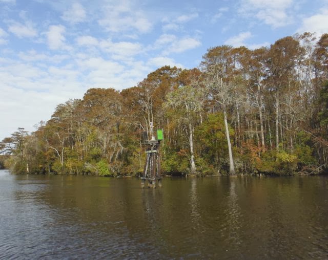
fog at high tide--only the top of the marker is visable

We woke up early, prepared to leave on the high tide, and found what we had not encountered yet on this trip: fog. Considering the options, delay leaving and go through some of the shoal areas at low tide or depart into the fog, we chose the latter. There is very little traffic on this part of the ICW, and no commercial traffic, so we felt fairly confident we'd be in no danger of collision.

Nor would we lose our way. The GPS is invaluable here. The magenta line is on the nautical chart on the screen, and instead of navigating by sight from buoy to buoy, we just kept the icon for the boat on the magenta line on the GPS screen. Out of the fog, a red day marker emerged. I found this on the GPS screen, touched the screen to select it and told the Garmin to navigate to the buoy. It told me the distance: .25nm. So visibility was about a quarter mile. Plenty of time to avoid an oncoming boat should one appear. Which it didn't.

We were fairly confident in our ability to navigate safely. We were also relieved when the sun broke through and the fog lifted. It turned out to be a lovely, sunny, and fairly warm day.

The day was another one of travel through desolate country, winding streams, and estuaries. Narrow channels and shoals on the curves. Not without some drama. We overheard a radio conversation. Excalibur has gone aground and called the tow boat. There is a give and take between them. In the meantime a motor cruiser comes on the scene and offers to throw up a large wake to "bounce you off the ground." We lose contact from there, but soon a tow boat passes us to port. Apparently the large wake was ineffective. Before long, we see Excalibur up ahead. He has taken a turn too sharply, but the tow boat has pulled him off. We radioed the towboat to ask of it is safe for us to pass, keeping wide of the grounded vessel. He assures us we are in the right channel. We get by in water that is plenty deep.

Off the shoal, Excalibur pulls in behind us as we cross the sound. Looking at the chart, the commander finds enough depth to cut off a red buoy, making one side of a triangle whose other two sides are the magenta line. She saves some distance. But Excalibur stays left, following the magenta line exactly. After his experience with the tow boat, who can blame him.

Below Savannah, we cross the Moon River. Here I regret to report that the geographical certainty most widely held among the baby boom generation is false. Moon River is not wider than a mile. At its mouth it is 0.7 miles across, and there is a small island in the way at low tide. I am crushed. I ask the commander how wide Moon River is. "Where is that?" she asks.

I have read that the county named the Moon River in deference to Johnny Mercer, who lived near Savannah, after he wrote the song in 1961. Before, it was the Back River.

We're at the top of the barrier islands off Creighton Island. We've had another fairly easy, long travel day, and we have the anchorage in the wide, quiet stream to ourselves.

11/17/13 Creighton Island, GA to Cumberland Island, GA, Terrapin Cove 48.5nm.

This is our fourth consecutive day without an interface with civilization. We like the independence and solitude. But supplies can start to run low. You can run out of fuel, run out of water, run out of wind, run out of all kinds of things. We have run out of chocolate. Our supply of miniature Snickers is gone. Both of us thought we had another bag when we left Charleston. Is this enough to drive us into the next town? This is Georgia. There are no next towns or very few. Brunswick looms in the distance, but it is several miles up river. Not worth the detour. The commander makes a batch of brownies that will have to hold us until St. Marys. It's hard to conserve.

You can also run out of water under the keel. The guidebook explains that Georgia and South Carolina have very little money for dredging to keep the waterways open. I'm not sure who is responsible for this--the states or the Army Corps of Engineers, or maybe it's a shared responsibility. But Georgia, in particular, with all its curves and twists, seems to have a problem with shoaling.

We reach the canal north of Jekyll Island just at low tide. A shrimp boat hurries out, booms and dredges pulled in tightly, passing us to port. Halfway up the canal, a sailboat is stuck in the mud. Our depth finder is reading a foot or less under the keel. We creep by. We are within shouting distance of him. He draws five and a half feet, a foot more than Luna's shoal draft keel. A little right, a little left, the depth finder is reading in the tenths and zero at one point. We do not go aground, but it takes nearly an hour to traverse the 1 mile canal, and we're tense the whole way. At the helm, I'm afraid to look at the depth finder, but know I must. We finally reach the Jekyll Island bridge and deeper water.

There's a marina after the bridge ($2.00 per boat foot per night), and lots of boats anchored off the waterway beyond. There's a public boat ramp and a dinghy dock so you can motor over, tie up and walk into the town. It looks like a nice place to stay, but we're so put off by the shallow canal, we just want to move on. We go another hour to Cumberland Island where we will spend a few days exploring.
A flashing green buoy points the way at Cumberland Island

The first anchorage on Cumberland Island from the north is Terrapin Cove, and it's lovely. It's too open and exposed to stay in rough conditions, but no winds is expected overnight. There may be rain coming. The place is beautiful. a narrow beach to the east, an expansive view to the west. Lots of open water in between. We're the only boat we can see. "Like Lake Champlain on steroids," the commander notes.

The rain does not reach us, but the clouds to the west produce a magnificent sunset that seems to take hours to trail off finally to darkness. We look forward to walking the beach in the morning.

11/8/13 Terrapin Cove to Brickhill River. Cumberland Island, GA 4 nm.

The fog is back. Eldridge's book on tides, that great source of nautical tidbits, notes that fog happens when moist air cools. Cooler air holds less moisture, so what is there condenses out into fog. This is common in the north Atlantic where moist air over the ocean meets cooler air in the atmosphere. Fog dissipates once the air has warmed.

In this case, there is fog because the humidity is so high. Last night we saw a rainbow around the nearly full moon, a sign, according to Eldridge, of rain coming. In any case, we can't see very far. We hear a boat engine in the distance. I get out our fog horn, a human lung-powered affair that makes an amazingly loud noise. One short blast, one long, one short to signify a boat at anchor. The boat passes by unseen.

Eventually, the fog clears. The narrow beach is gone, and we are looking at trees. We are a thousand feet away from where we dropped the anchor. For the first time on this journey, the anchor dragged overnight in the changing current. No harm is done. Eventually it reset itself and is holding fast. There are no shallows nearby and no other boats with which to collide. But the potential for harm is there.

There was no wind overnight, and the seas were calm. The bottom is muddy and there is good anchor holding reported. However, the currents are strong here and reverse with the tide. Often I noticed Luna riding perpendicular to the anchor line. I imagine the lateral stress on the anchor caused it to drag. To prevent this in the future, we can put out two anchors, one upstream and one downstream. Or we can put out more anchor rode. We arrived near low tide, but with an eight foot tide, I should have put out fifty feet more of line to maintain the recommended 7:1 ratio of anchor rode to depth.

Since we're so far from the beach, we give up on the idea of a walk and move on to the next anchorage. This is on the Brickhill River near a remote campground on the island. There are reports that you can land your dinghy, pick up a hiking trail and walk two and a half miles to the beach.

There is another cold front coming with strong northeast winds and small craft warnings off shore for the next couple days. The anchorage is well-protected from the northeast. We never could find a place to land the dinghy, however. At all but high tide, steep muddy banks and marshes separated water from land.

There is some boat work to do. I opened the engine compartment to tighten the generator belt that was squeaking and found the front of the engine coated with salt. Water is dripping out of the sea water cooling pump that Phil and I had repaired the day before we left Vermont. Anticipating trouble, we had spent an extra day at the marina in Cape May so they could order us a replacement. It was time to put it on.

I have been thinking about this ever since Vermont. The mechanic in Cape May advised not replacing the old pump as long as it seemed to be working. However, it would be easier to do the work at a marina with all available tools than off at a remote anchorage somewhere. So, I've been a little uneasy, expecting the inevitable failure.

WD 40 is a wonderful thing. I am able to remove the fittings and pulley from the old pump and put them on the new pump without too much fussing. The new one is installed and working just fine. Water is spitting normally from the exhaust.

Life is good. But a question nags at me. Owning a boat, especially an older boat, is a continual process. You make improvements, you anticipate problems, and you fix things as they go wrong. So far so good. I like diagnosing problems and tinkering. I like the challenge of devising unconventional ways to do things, like getting a pulley off the water pump spindle without the special tool designed for this purpose. But I wonder at what point and under what circumstances a problem may arise that I am not able to fix.

11/19/13 Brickhill River to Plum Orchard, Cumberland Island, GA 4 nm.

Finally, a day to sightsee on Cumberland Island. We motored a short distance down river to a National Park Service dock at Plum Island, site of a Carnegie family mansion. We anchored in the river and dinghied ashore.

Andrew's brother, Thomas, purchased much of Cumberland Island and built a mansion, Dungeness. This was on the site of the original Dungeness, built by Nathaniel Greene, a Revolutionary War hero, in 1783. Apparently he purchased the island and harvested the live oak trees for ship building. The USS Constitution (Old Ironsides) was built with Cumberland Island oak.

The original Carnegie mansion burned in 1959, and the ruins are still visible on the other side of the island. Plum Orchard is one of the homes Thomas' wife, Lucy, built for her children. Like the park itself, the house was donated to and preserved by the National Park Service.

The house was open, and we peeked inside. There were a score of volunteers putting up Christmas decorations. Bruce, a park service volunteer from Minnesota with a winter home in Georgia, was available to give us a tour.

Guided tour of the "Gun Room" at Plum Orchard
To call this a house is an understatement, of course. We're thinking Downton Abbey. At one time, 50 servants were employed in this 21,700 square foot mansion. There are high ceilings, an indoor pool, and the house is divided so that servants could go about their jobs unseen by the house's other residents. There is a board in the kitchen to inform the servants the location of someone in the main house calling them. There is a bell at the grand staircase that was rung when it was time to dress for dinner. There is a squash court near the pool and a tennis court out back.
Down the path to the beach from Plum Orchard

Lest we start to consider that our need for living space might start to outstrip what Luna has to offer, we took a walk on the carriage road and path to the beach. Bruce said if we anchored lower down on the island by the ferry dock, the walk to the beach is only a quarter mile. The path from Plum Orchard is 2.5 miles long. Considering that it has been 6 days since we have been off the boat, we had been looking forward to a real walk for days.

The seashore is deserted. The north wind is blowing sand down the beach, so we sit in the shelter of a dune to admire the view before returning. There are signs here and there of the island's population of feral horses, but we see none until we return to the house, where three are calmly grazing on the lawn. We walk past swampland, expecting to see alligators. We did see an armadillo.
Small craft warnings off the beach at Cumberland Island

Our plan was to spend the night and motor to the ranger station at the south end of the island tomorrow. But the wind has come up, and as elsewhere, the interaction of the tide, current and wind has Luna in a compromised position too near the shore and sideways to the current. We were able to back her up, take up the anchor line, and set a second anchor to hold her toward the middle of the channel. We decided that given the forecast for continued high winds, we should leave and sail directly to St. Marys, on the Georgia mainland.

Stuff doesn't seem to happen when seas are calm, and there is no sense of danger or urgency. It doesn't happen during the 90 percent or so of the time we could call boring. We're idly floating along. Mindful of the buoys, of the course on the chart, chatting with each other, tuning in to how Luna feels. Watching the sky. Feeling the breeze. Trying to discern that magic point where water turns to marsh grass turns to sky. Listening to Luna's bubbling exhaust, which seems now to be going in perfect 6/8 time. Echoes of Gilbert and Sullivan play in my head:

I'm very well acquainted, too, with matters mathematical,

I understand equations, both the simple and quadratical,

About binomial theorem I'm teeming with a lot o' news,

With many cheerful facts about the square of the hypotenuse.

I'm very good at integral and differential calculus;


I know the scientific names of beings animalculous:

In short, in matters vegetable, animal, and mineral,

I am the very model of a modern Major-General.

Which I fancy myself to be. No, this is not when stuff happens. On the other hand, you're at the conning tower of the sub under your command, You raise the periscope to have a look around. There are enemy sub chasers everywhere you look. You slap up the handles on the periscope. It slides down. DIVE! DIVE! AOOGAH! AOOGAH! Down you go, but the enemy has seen you. Depth charges drift downward and explode around you. The ship rocks violently. Men are running everywhere. This is when stuff happens.

Twisting in the strong current and wind, anxious to get to a more sheltered place, we hoist the anchors, and as the commander powers up to leave, the transmission locks up and the engine stalls. We can go backward, but not forward. We reset the anchors  and called our friends at TowBoatUS. Thanks to the towing insurance we bought, the $900 towing bill, inflated by the strong windy conditions and growing darkness, cost us nothing. The boat brought us to Amelia Island Yacht Basin in Fernandino Beach, Florida, where they will check the problem in the morning. Meanwhile, we're tucked in, made fast securely to the dock, and here in Florida.


Luna's wake carves an interesting pattern on a cloudy morning


Friday, November 15, 2013

I'm through with everything here. I want peace. I want to see if somewhere there isn't something left in life of charm and grace. Do you know what I'm talking about?….I'm going back to Charleston, back where I belong.

Rhett Butler.  Gone with the Wind

From the Captain

11/9/13 Price Creek to St. Johns Yacht Harbor, Stono River, Charleston, SC, 23nm
11/9-11/14/13 Charleston, S.C.

After a short half day trip. we reached Charleston and the marina where Phil and Nancy are spending the month of November. They have rented a car, so we have access to Charleston and lots of stores. During the time we were here, we visited Costco, Lowe's, Harris and Teeter supermarket, West Marine, and Whole Foods. We visited a nature preserve and hiked around old rice fields. We strolled around at the huge old Charleston Navy Yard, decommissioned in 1996 and now a public park. And we walked around the old part of downtown Charleston and the Charleston waterfront.
Hidden courtyard in Charleston

I loved the old section of Charleston. Beautifully preserved old houses, mostly masonry now after a series of fires in the 19th century, are set closely on well-treed streets. Columned porches, high windows, grand doorways grace the larger places. Hidden courtyards and gardens are revealed to the viewer peering through closed wrought iron gates. Horsedrawn carriages guide tourists to the noteworthy parts of the area. Phil joked that it must be hard for the horse to stand quietly listening to the same old jokes day after day.

The horses exact their revenge of sorts. The areas where they walk are redolent in odor of horse. Clearly, magnolia season has not started yet. The smell adds an aura of authenticity and history to the quietly magnificent area. On the other hand, the parts of the city where the horses don't walk smell rather sweet--there are roses and flowering trees in bloom, even in November.

The architecture and planning in Charleston are remarkable in other ways. We drove right by a Lowe's store and a Costco store, and I didn't know either was there. There are shopping plazas but no large malls. And the plazas are shaded by trees and don't announce themselves to the passers by with typical large roadside signs. There is a decorum here, a tradition that seems to be carried forward from the stately mansions to the modern consumer outlets. It is strip development with a southern charm.

Another aspect of the city's friendly and manageable feel is that there are no skyscrapers. A visitor focuses on the beauty of the architecture, not the wonder of the engineering. You can see the sky and don't feel closed in when you walk down the streets. The tallest building downtown is an ancient hotel on the waterfront. It has been converted to condominiums, and our friends, Craig and Nancy Roskam from Colchester, have a small apartment on the fifth
floor. We visit and admire the view out over the river. There are only two floors above them.

A well known Burlington figure, restauranteur Jack Hurley, has settled with his family in Charleston. He owned the Daily Planet, Black Rose Cafe, and was responsible early on for the restoration of the Old Dock Restaurant in Essex, NY. Now he has a couple successful hot dog stands (Jack's Cosmic Dogs) and a Mexican restaurant (Mex One) here in Charleston. Naturally, we tried both.

Walking in Charleston's Waterfront Park

We strolled around the waterfront and downtown. Of course, we visited the slave market. This is a long, low narrow building with open sides. Here slaves were penned and chained, bought and sold. Now it is an open market with stalls for craftspeople. Several are selling sweetgrass baskets, finely handcrafted in various sizes, that go back to the slave traditions. I bought a small bag of grilling spices from another vendor. In no place I could see was there mention of the original function of the building or the slaves who, directly or indirectly, were responsible for all this: the rice plantations, the fine mansions, the sense of grace.


Interestingly I'm reading in Michener's historical fiction, Chesapeake, about slavery in the time leading up to the Civil War. Eerily foreshadowing much of the political discourse today, the issue was framed as the government's trying to take away personal liberty (the freedom to own slaves), and trampling on the rights of states (to permit slavery). And the government taking away your so-called property (slaves). In a bizarre twist of logic, the southern view, the Civil War was a fight for freedom

Our plan was to leave Charleston on 11/12, but forecasts call for another cold front, more severe than earlier ones, to pass through on 11/12. Our marina is comfortable, friendly, and not too expensive. We sign on for another couple days.

Weather prediction down here seems better than in Vermont. Perhaps this is due to the presence of ocean shipping here or maybe with the ocean nearby, frontal behavior is easier to predict. I have come to trust what I hear from NOAA. They called for strong north winds 25-35 kts for the 24 hour period starting around midnight 11/12. This will continue on the 13th, and low temperature on that day will be around 30 degrees. No sense traveling under those conditions.

Lunch at the Hominy Grill
We wake up on the 13th after a night of howling winds that sound malevolent in the rigging. Temperature in our refrigerator reads 41 degrees, as it usually reads. Temperature in Luna's cabin is 47 degrees. We are daunted to know we share the same decade of temperature with the milk that goes on our Cheerios. But the sun is out, we put the space heater on. We take hot showers in the marina. The commander lights the oven and makes muffins. The cabin is warmer. The day never really warms up much because of the north wind. Phil and Nancy drive us into town, and we have a nice lunch of shrimp and grits, she-crab soup, peas and rice, and extra cheese grits at the Hominy Grill.

Staying here is good in that we're sheltered from the worst of the weather. We are with friends. We can restock. I even get some projects done on Luna. Change the oil and filter. Clean and pump the holding tank. Trouble shoot a sluggish starter motor. Take the outboard engine to a shop for a tune up. Re-fasten the newly sealed mainsheet traveller and seal around parts of the cabin windows.

But then staying put becomes uncomfortable in the sense that Luna seems no longer a character in our lives here. She has become a motel room. And we find ourselves impatient to return to the slow pace of water travel. The hidden wonders around the next bend. The hours of boredom at the wheel when the mind wanders in the stream of consciousness. The occasional periods of panic and action which keep the senses keen and the mind sharp. In Charleston, we are back on land, back in the car, back to a faster pace.

The winds are scheduled to abate by morning, and slack current tomorrow is at 6:38am. It will be cold, but we're hoping to leave early before the strong tidal current keeps us pinned here for another 6 hours. We will be heading back down the ICW toward Georgia.


Luna in the background at St. John's Yacht Harbor, Charleston


Sunday, November 10, 2013


 The main question is whether two people who don't know anything know more or less than one person who doesn't know anything.

Click and Clack, the Tappet Brothers.

From the Captain

Back on the move into South Carolina

11/4/13.

Three B's of a good stay: Barney, Beach, Barbecue
We're moving again after a three day break in Carolina Beach. The interlude with my brother, Barney, and niece, Samantha, was a good one. We stayed with them in their beach house. We walked on the beach and collected shells. Ate barbecue. Did laundry and shopping. Visited some of the interesting local spots like the Tiki bar, on a  short pier that doesn't quite reach the ocean, and the Fat Penguin, one of the most interesting beer joints I've seen. The Penguin is remarkable in that  there is a large cooler with a huge selection of beers (none from Vermont, curiously). You pick one, pay for it at the bar and walk through a confusing maze of spaces to find a place to sit and drink it. We went outside to a covered patio with a sand floor and a outdoor fireplace going. We struck up a conversation with some of the good old boys who are regular customers. It was the first time I heard the term "war of northern aggression" used in a conversation.

Barney and Sam with us on Luna
We also took the spinnaker off the boat, washed it, let it dry, repacked it, and left it with Barney. After three unsuccessful tries raising it, I don't think it's worth the space it takes up to keep it. We'll pick it up on the way back. Once back home, I'll ask someone to make sure our equipment is correct and then go out with us to show us the right way to fly it.

Back on Luna yesterday afternoon, we met new dock mates, Jim and Bonnie on their Morgan 38, Dana. They are traveling south from Long Island, and this is the second time they've made the trip. They invited us over for cocktails (bring your own) to tell us about their first trip to the Bahamas. Interestingly, they've followed the same route as we have: Dismal Swamp to Elizabeth City, to Manteo, to Ocracoke to Oriental.

Conversation turns to when we should leave in the morning. High tide slack current is at 10:30 am, and Jim suggests leaving then for a fast ride down the Cape Fear River on the building outgoing current. On the other hand, the commander reads in the guidebook that if you leave Carolina Beach at high tide, you will have a swift current coming at you when you get down to Southport and turn away from the Cape Fear inlet. If there is an opposing wind the waves can be quite steep. We discuss this and decide to leave at 9 am, missing some of the benefit of the current, but avoiding the largest waves in Southport.

The cruising guides warn strongly to avoid being influenced by others who seem to know more than you and induce you to go out in conditions your gut tells you are wrong. The discussion among the four of us about when to leave bears some of this flavor, but in the end, we reach a compromise acceptable to all, and as it turned out, we made exactly the right decision.

We're up early and get ready to leave at 9. First, Luna's engine has been running a little hotter than normal, so I spent some time cleaning out the water intake strainer. The antifreeze level was a little low, so I topped that off. We started off, and before we got out of the harbor, the engine temperature started to climb quickly. There is no cooling water circulating through the engine, none coming out of the exhaust. It was working fine when I tested it earlier. Luckily, we can unfurl the jib and turn off the engine while I check it out. Most likely, the water pump lost its prime and there is air in the line. I disconnected the line, sucked some seawater through it and reconnected it. The diesel ran just fine after that and much cooler than the past few days.

The strong north wind against the jib helps push us southward. We're making 6-7 knots, and although the river is quite choppy, we have no trouble navigating the current. We pass a restricted area. It belongs to the military and there is a patrol boat waiting to push anyone aside who enters the restricted channel. It turns out this is the place where nuclear weapons are loaded onto ships. I wonder if this is the Sound of Freedom. The nautical chart calls it the Shoal of Midnight. We stay well within the main channel and out of trouble.

In Southport, we were able to tie up to the free town dock. Our friends on Dana were anchored in the small harbor. When they arrived, there were two boats rafted together on the dock. As we arrived, the two boats left.

We had the afternoon free to have lunch at Fishy Fishy, a local seafood restaurant right on the harbor.
 Lunch in Southport
We walked around, did some shopping. It's been so cold in the evenings, I bought a pair of fleece sweat pants. I'm convinced that now that I've done that, the weather will get much warmer. I don't mind taking one for the team in this way.

We learned a little local history. Southport figured prominently in the Civil War, as it was an important port for the southern states. Ships laden with cotton and tobacco and other products left the Cape Fear inlet bound for the Bahamas where they picked up military supplies. They returned past Southport on their way back up the Cape Fear River to the major shipping port of Wilmington.  As soon as the South seceded from the Union, President LIncoln ordered the blockade of all southern ports. Blockade running became a major industry in Southport, and local pilots who could guide ships in through the maze of dangerous shoals at night became local heroes. One of the biggest houses in town belonged to a river pilot.

Walking back to the boat, we passed three men discussing fishing at the back of a pick up truck. One of them stopped when he saw us. "Do you want to use my truck?" he asked. "You can take my truck if you want to do some shopping. Go out to Walmart if you need to. Sorry I didn't ask you sooner." I keep getting this feeling that somehow we've entered a parallel universe in the world of "Nice." We thanked him and told him we had just come from Carolina Beach and had gotten all we needed there for now.

Later in the afternoon, we returned the favor to the folks on Dana and had them over for happy hour on Luna. We talked about the next day's travel. They are off early and plan to go about 50 miles. We are enjoying the rather relaxed pace and need to stop at a marina first to pump out our holding tank. The commander has charted the next segment down to Charlestown, and tomorrow calls for a 30 mile day to Calabash Creek. The distance seems about right to us.

11/5/13 Southport to Barefoot Marina, North Myrtle Beach, S.C. 38nm.

We were up and off the dock early, tying up next door at the Southport Marina for a pump out at 7am. With the time change, the sun sets early We are trying to be done with traveling by 3pm.

The morning is cool and drizzly. The sweatpants I bought yesterday did not bring the warmer weather. In fact, there was no electrical connection available at the public dock, and we couldn't use the space heater last night. We had a cold night aboard Luna. It was 57 degrees in the cabin this morning.

I didn't sleep well for other reasons. For the first time, we are faced with significant tides. Tidal change in the Southport harbor is over 5 feet. We made our dock lines fast at high tide. After lunch, we returned to Luna to find her several feet lower than we had left her, and our dock lines were taut. Our friends from Dana tied their dinghy to the dinghy dock, and as we walked past we noticed it was resting on the exposed harbor bottom, its outboard propeller buried in the mud.

I loosened the dock lines, but we went to sleep at high tide and low tide was scheduled for 2:30 am. I tried to guess just how much slack I should allow. I slept fitfully, waking at 2:45 am to check the lines. They were tight, but still allowed some slack. Just right, I thought. I finally fell asleep on the rising tide.

We were favored again by a north wind and could unfurl the jib to help our speed. As in Vermont, however, the north wind brings the colder air. Our goal for the day was Calabash Creek, a mile or so downstream from the town of Calabash, N.C. I had been hearing about Calabash style cooking. Calabash calls itself the seafood capital of the world, and their style of cooking involves deep frying very fresh fish and shrimp. I read that the famous entertainer of radio and early television, Jimmy Durante, visited Calabash and impressed by the food,  became acquainted  with Lucille Coleman, owner of Coleman's Restaurant. His well-known sign off, "And good night, Mrs. Calabash, wherever you are," referred to Lucy. With all that in mind, I thought we should at least put our nose into Calabash.

However, we bypassed Calabash Creek. We were making good time with the north wind and didn't feel like sitting around on anchor in the cool damp weather. We kept the bow pointed south. Or rather west in this area. We passed into South Carolina right at Calabash Creek. We made another 15 miles down to North Myrtle Beach. I put Calabash in my growing mental file under "places to check out on the way back."

Right past a swing bridge, Barefoot Marina is a nice place, fairly inexpensive. There are concrete floating docks. Though this sounds like an oxymoron, they are very solid structures, and we made fast to the face of the dock right on the waterway. There is another set of docks across the waterway in front of a large shopping center. Boats tie up there, too, but there are no shower facilities. There are restaurants, however, and a short walk across the bridge gets us there for happy hour.

As we were leaving for our walk, we passed a group of local residents chatting on the dock. A woman staying aboard with her husband recommended the Flying Fish for happy hour. We were ahead of her on this one. We were halfway down the dock when she hurried back to us. "I should have offered you a ride," she said. "Would you like a lift over to the restaurant?" Looking forward to a walk after a day on the boat, we gratefully declined. She described a short cut for us through the complex out to the bridge.

Another alien from the world of Nice. It occurs to me that this is the polar opposite of the zombie apocalypse. Or any of the other doomsday scenarios the movies and news media try incessantly to instill in our imaginations.

At the Fish, I asked the bartender if they had anything that was Calabash Style. She said, "Honey, this is Myrtle Beach. Everything is cooked Calabash style." We had some fried crab cakes, a shrimp salsa, and for dessert a half dozen Chesapeake Bay oysters. We bought a couple crab cakes from the attached fish market to take back for dinner tomorrow night. 

11/6/13 Barefoot Marina to Jericho Creek, off the Waccamaw River 38.5 nm

View of the Ditch, Barefoot Bridge
They call this part of the Intracoastal Waterway, "the ditch," most likely because it marks the transition from coastal bays and streams to a canal which is straight and man made. This part of the ditch outside Myrtle Beach is loaded with condominiums, fairly unattractive single homes, overly large Florida style villas, and over a hundred golf courses. There is very little vegetation between waterway and housing projects. I can't imagine wanting to live here.

Several of the golf courses had greens placed precariously and in my mind, somewhat sadistically close to the water's edge. It seems like the South Carolinians prefer their golf as they do their politics: straight ahead and keep to the right. Veer to the left even a little, and you'll find yourself in deep water.

Large lawns down to the water's edge and golf courses with their chemical lawn treatments can't be good for water quality, and I thought back to the marshes and empty islands of the other Carolina.

I am happy to report, however, that once past a comfortable commuting distance from Myrtle Beach, the tacky development gave way to woodland, and the ditch became more like the Dismal Swamp on steroids: wider and with more Spanish moss draped on the live oak trees. This has been called one of the most beautiful parts of the ICW. Fall had changed the trees. Compared with New England, the colors were muted. But none the less magic.

Fall colors are muted but present
The ditch joins the Waccamaw River. Downstream a bit, we found a detour--Prince Creek, a narrow stream that wound for a few miles from the main channel to rejoin it later. Taking it might add some time to our trip. We took it. It was worth it. When global warming changes Vermont back to a swamp, this would be like cruising up Otter Creek from its mouth to Vergennes. Except there was only one little house and no other sign of human occupation. When we rejoined the waterway, we were right behind a Canadian sailboat that was behind us when we turned off. We lost very little time, and the experience of solitude and peace and natural beauty made us wish the cut were twice as long.

Our goal was an anchorage behind Butler Island,  a large island in the river. However, we had a fairly strong tailwind and had sailed much of the way up. We saw that the anchorage was exposed to the northeast wind that had propelled us. As we approached the island, we noticed a small well-protected creek off to starboard. The water looked completely flat. We checked our sources (Skipper Bob's book of Intracoastal anchorages and Active Captain) and found Jericho Creek listed in both. We took an abrupt turn to starboard.

These lowlands are Carolina rice country. Georgetown, the next nearest town, is the home of Carolina
Quiet anchorage on Jericho Creek
Rice. Once in the creek, we were shielded from the wind, but there was a fairly strong tidal current coming downstream. Our sources directed us more upstream to an oxbow about a half mile away. On the way, numerous ditches and streams branched off into the rice fields that lined the creek. No doubt these lowlands could absorb most of the tidal flow. By the time we reached the oxbow, there was very little current, and we anchored in about 12 feet of water in a very secluded and peaceful spot.

Aside from a fisherman in a skiff returning somewhere upstream, we saw not another soul. Owls hooted us to sleep.

11/7/13. Jericho Creek to Price Creek, 20 miles north of Charleston, S.C., 48 nm.

The commander woke up and announced, "Hey, this is the first day the butter isn't hard." We keep the butter in a sealed plastic container out on the counter.

Thanks to all the planning we did, or perhaps just to dumb luck, there have been very few surprises so far on the trip. But one thing I did not plan for was all the cold weather. My thought was that once we got down the the Chesapeake, it would be shorts, T shirts, and bathing suits. I packed accordingly. This concept held for the first week or so. But it has been cool ever since. Most of the wind in the past 6 weeks has come from the north, and as in Vermont, this brings colder air. Nights have been in the 40's, and 50's, and daytime temperatures in the 60's and 70's, or less if the sky is cloudy.

I did bring a pair of jeans, a couple wool T shirts and pairs of wool socks, a warm jacket, and a windbreaker. A wool sweater and watch cap, and a pair of windproof fleece gloves. In retrospect, I should have brought a cozy fleece jacket or sweat shirt and pants, a couple more long sleeved T shirts, and some warm slippers. The commander had more foresight, of course. As it is, we're putting on more miles to get further south. We'll catch the cold weather on the way back up, however.

We weighed anchor before 7 am and rejoined the Waccamaw. This gave way to another "ditch," and gradually the low country grasslands and woods became coastal estuaries and small islands, as up in North Carolina. Back to interesting small houses and fishing skiffs along the waterfront. We put on about 50 miles by 4 pm and anchored in Price Creek, which winds to the east to join the ocean. Holding was good on the sandy bottom, so we were confident anchoring despite the tidal current. We could hear the ocean from where we sat.

Faced with a choice of taking the dinghy for a short ride to the beach or sitting in the cockpit to watch the sunset over the grassland, we chose the latter. Later we reviewed the most recent weather forecast. After midnight, there will be 25-30 kt north winds and a six-foot tide.  We put out more scope on the anchor line and got ready for a noisy night  of halyards slapping on the mast and wind whistling in the rigging. We were securely anchored, protected from the waves and actually managed to get some sleep. Before retiring, we took a moment to step out onto the deck and look at the stars shining brightly in the moonless sky.

11/8/13 Price Creek

We spent another day at Price Creek. Overnight, the wind was howling. Waking up, we found pretty much the same conditions. And the butter was hard. It was cold again last night.

There are small craft warnings in Charleston Harbor. Draw bridges in the Carolinas don't open if the wind is above 25 kts. We felt if we left our secure anchorage, we might not be able to get all the way to Charleston and would anchor in a place that might not be as good as the one we're in. So we are staying.

This is not a tragedy. It's lovely here. We can spend the day reading. We can do some boat projects. We can walk on the beach. Or we can do all three of those. Which is what we did.

I have identified one of the cabin leaks as coming from the bolts holding down the mainsheet traveller that sits on the cabin top. We removed this, cleaned off the bolt holes, and reinstalled it with new bedding compound. I put sealer around the cabin windows.

Whelks and sand dollars were plentiful
Later in the afternoon, an hour before slack current, we took the dinghy over to the beach at the Price Creek inlet. It was low tide. The sun was low, casting long shadows over the sand. We had the place completely to ourselves. We walked along the beach collecting shells.There were sand dollars everywhere we looked. And large whelks. Like you never find anywhere because someone has already collected them.

Back on Luna, the sun was going down, The crescent moon was setting, Venus shone brightly up in the sky next to the moon. The sky was turning all sorts of interesting shades of red, purples, blues, orange, and some yellow. The clouds were afire with the glow of the setting sun. Dolphins were swimming around the boat, chuffing as they surfaced. The seagrass on the shores around the creek caught the glow of the setting sun. We wondered--could it get any better than this! We agreed this is the best anchorage yet.
Secluded beach at Price Creek inlet


The wind is abating. Tomorrow we will leave for Charleston.


Sunset on Price Creek


Saturday, November 2, 2013


From the Captain

Back to the Magenta Line

10/28/13 River Dunes Marina to Beaufort, N.C. 26.7nm

After 10 days of wandering the outer banks, we are back with the program. We joined the ICW again in the middle of the Neuse River an hour or so after leaving Broad Creek. The chart took us to Adams Creek, widened at the far end to a canal that ended near Beaufort. Our plan was to reach Morehead City, where we had made marina reservations. On the way, we got an email that our friends, Craig and Donna on Mighty Fine, were anchored on Taylor's Creek at the Beaufort waterfront and liked it so much they were spending a second night.


The guidebook tells of current changes on Taylor's Creek and recommends using two anchors. I noticed most of anchored boats had just one. The current follows the ebb and flow pattern that has
The waterfront of Beaufort from Taylor's Creek anchorage
formed our days since the Hudson River. During the flood, the incoming current turns Luna one way. The effect builds for three hours then subsides to the slack current. Then, the direction switches and follows the same 6 hour cycle. Luna turns 180 degrees. The affect is altered by whatever wind blows into the mix. The water is otherwise calm, and there is very little wind. We set just one anchor.

We dinghied ashore and walked around the waterfront. These little towns are similar in many respects. Their reason for existence was as shipping ports, and when bigger ones displaced them, they turned to fishing. Now the seafood packing industry is in decline or perhaps consolidated elsewhere. Since the 1970's, Beaufort and others have been boating towns. There is a cute shopping district by the water front. Houses in the old section are well preserved, many proudly displaying their year of construction, generally in the mid or early nineteenth century. The rest of the town happens elsewhere.

We stopped in a waterfront store and asked where the hardware store and grocery were. "About a mile and a half from here. On Live Oak St. There is a lot of traffic. Not a great walk." We visited the North Carolina Maritime Museum instead. We highly recommend this well-displayed museum. There is a fascinating exhibit of the history of the coastal rescue corps. As in Ocracoke, Blackbeard figures prominently here. His flagship, Queen Anne's Revenge, sank in the Atlantic off the Beaufort Inlet, and just today, we are told, they have raised another cannon from the site. There are many artifacts from the ship in the museum's collection already.

Craig is a bit of a techno-geek, and they invite us over at night to watch the World Series on their flatscreen TV. He can get two different Fox channels locally and has a satellite dish if that fails. The commander bakes a pan of brownies to bring to the party.

Being back on the magenta line lends a subtle shift to the vibe of the trip. The line comes from somewhere and goes somewhere. It's linear. There is an origin and an end.To decide to stop creates a vague sense of dissonance in the well-developed and stubborn part of my inner self that is goal directed and values the successful completion of a task almost above all else. On the other hand, Beaufort seems like a pleasant place to be. We take a (small) breath and decide to stay another day.

10/29/13. Beaufort, N.C.

Today started with no coffee. The burner on the stove lit and promptly died. The propane tank is empty. I called the public marina, and they directed me to a source of propane on Live Oak St., about a half mile away. I unscrewed the tank, carried it ashore, and started walking. The place where he directed me, a dealer of propane stoves and heaters, could fill it, but not until 4pm. They suggested another place, "two long blocks away."

The propane tank weighs 15 pounds and another 10 pounds once filled with propane. But I started walking and found the place--right near the hardware store we asked about yesterday. It wasn't such a bad walk, but I was having misgivings as I hoisted the 25 pounds onto my shoulder and started walking back.

Luckily, a driver hailed me as I was walking on the sidewalk: "Would you like a ride? I know just what you're doing," he said, "and I know exactly where you're going." He is a sailor and is getting his catamaran ready to sail back to the Bahamas for the winter. He's done this trip to and from the propane dealer many times before.

I'm Tennessee Williams' Blanche Dubois, once again depending on the kindness of strangers. Fortunately, among the boating community. kindness seems to abound.

Boardwalk into Carrot Island, the Rachel Carson Reserve

Taylor's Creek is a narrow passage. To the north is Beaufort. To the south, very close to where we are anchored, is Carrot Island, home of the Rachel Carson Reserve. dedicated to studying and preserving the health of the coastal wetlands. It is named for the marine biologist and environmental writer, who did studies here in the late 1940's. Eventually, Carson's book, Silent Spring, led to the banning of DDT and regulation of other pesticides and to the formation of the Environmental Protection Agency. I am warmed by the fact that North Carolina would choose to memorialize her in this way.

We motored the dinghy up to the eastern end where there is a boardwalk into the center of the island. We pulled the dinghy up onto the sandy beach that rings the island. We learned that North Carolina has nearly 3 million acres of estuaries, more than any other state in the eastern U.S. Estuaries are tidal marshes that purify the streams running into them and serve as breeding grounds for marine wildlife and habitat for birds. Carrot Island is also the home of a herd of wild horses, whose ancestors were left on the island to graze by a local resident in the 1950's.

We walked onto the boardwalk and could see a few horses on the other side of the island. But later we could take the dinghy inland via a stream deep enough at high tide to allow us to motor up. This provided a very quiet and secluded view of horses, great egrets (cousins of great blue herons), marsh grasses and tidal pools.

We spent the rest of the afternoon back in town. We revisited the maritime museum. Out of the waterfront section, we found a natural foods market (Coastal Community Market), whose proprietress once had a time share in Stowe. We arrived just at closing and missed seeing the historic cemetery where soldiers from the American Revolution, War of 1812 and Civil War, families, free men, and slaves share a lovely, old shaded spot where large trees grow and paths wind among the old tombstones. We had sunset margaritas at a bar down by the docks, historically named, Queen Anne's Revenge.

10/30/13 Beaufort to Swansboro, N.C. Anchor outside Buoy 45B off the ICW.  25.2 nm

In the commander's estimation, today was the nicest day yet. The weather was sunny and pleasantly warm. Luna blurbled along under diesel power. The waterway here is a narrow channel down a series of estuaries. Interesting and not overly large houses line the right bank as we go along. Small islands with inviting sandy beaches and low vegetation separated by small channels line the other. Each house has a pier at water's edge, and each pier, it seems, has a lift for a boat. Today, it seems, everyone is on the water, and the main activity is fishing.

There are a lot of outboard powered skiffs, some with couples out for the day, others with young men fishing with nets. There are no fancy bass boats as in the northern Chesapeake Bay. People aren't fishing for trophies here. Everyone waves as they go by. A man not too far off the channel is standing knee deep in the water raking the bottom for clams.

We see several groups of dolphins as we go. Like a familiar neighbor of unfailingly good cheer, they always make us smile.

We find the anchorage next to a small island. Beyond the island another sailboat is anchored. It is a more private spot, quieter and off the main channel. We enter the passage north of the island, but the depth finder starts to indicate shallow water, eventually getting down to a foot under the keel. Wisely, the commander backs up. Later, the owner of the sailboat comes up in his dinghy. He tells us we could get into the channel for sure by going closer to the island. He is a fisherman, and today he has oysters to sell. Unfortunately, we have no way to open them on Luna, so we decline. We also decide to remain anchored where we sit.

We hear explosions in the distance, like fireworks on the Fourth of July, without the aerial display. Ah-WHOOMP, Ah-WHOOMP. We are just a few miles downstream from Camp Lejeune, the large Marine Corps base. They are taking artillery practice.

Later, another friendly boater comes by. He introduces himself as Dave, dock master for Swansboro, and offers us a place to tie up in town ("one of the local restaurants, if you just buy a beer or two.") Or, he will come by later and ferry us in and back if we would like. The commander is making a pizza from a portobello mushroom and asiago cheese we bought at the market in Beaufort. We have some red pepper and left over grilled chicken to go with. We decline the gracious offer.
Dolphins surfacing near Luna


The sun starts to go down. Ah-WHOOMP is heard in the distance. The locals call it the sound of freedom. Somewhere nearby a pod of dolphins surfaces. Their graceful arches, apparently unphased by the distant explosions, lead one to wonder exactly what freedom does sound like.


10/31/13 Swansboro to Sloop Point Anchorage, Hampstead, N.C. 32.4 nm

Ah-WHOOMP. Apparently the boys on the base are up early to take their best shots. The magenta
line goes right through part of Camp Lejeune. When there is artillery practice, the line of fire goes across the channel, and the ICW is closed for an hour or two at a time. It may be closed for 2-4 days if there is training for amphibious landings on the beaches. Today, we hear the waterway will be closed until 10 am.
Warning at Camp Lejeune

With all the fishing activity, we figured this would be a great place to look for fresh seafood while waiting the the waterway to open. A google search led us to Clyde Phillips Seafood Market right in town. I called and asked if we could get there by boat, and he invited us to tie up to their dock.

On the salty dock at Phillips Seafood
We made our way carefully down the channel and found the dock, tilted in places, missing a board here and there, crooked, and mooring a couple fishing boats in about the same state. The dock wove its way to a packing shed, and we walked through this to the storefront. The whole affair is best described as salty.

Salty is not just a polite way of saying dilapidated. Salty is to dilapidated as Vermont is to recycling. Back in Vermont, and maybe back in time, you used something up, then you fixed it, cobbling it back together as best you could. The constant drive to build or buy something new and bigger is a relatively new phenomenon. Otherwise, you used your ingenuity and whatever you had on hand to put it back together and make it work. The process got easier once duct tape was invented. Once it couldn't be patched up or fixed any more, you left it out on the lawn to use for parts and eventually to become one with the landscape.

Phillips' market may be merging with the landscape, but the seafood was top notch. We bought some
Clam sauce with fresh clams for dinner
fresh shrimp and a dozen clams that we would have for dinner later.

By the time we got to Camp Lejeune, the firing had stopped ,and we passed through without interference. The landscape is empty by the marine base, and more open. The low vegetation back from the banks revealed splashes of pale sages popping through drabber greens and olives of various shades, and brown. It could be a landscape painting perfectly rendered by the guy who does the camouflage clothes for hunters and jungle soldiers.

We passed two swing bridges on the way down, having to wait both times for scheduled openings. Several large cruisers passed us, their skippers slowing down to dampen their wakes. The wakes from small motorboats do not bother Luna when they pass her. When larger boats pass, there is a protocol to follow. As the slower boat, we put the engine to idle, and the passing boat likewise slows down so as not to throw us off course with a large wake. Once past, the faster boat speeds up.

 The marine base marked a change in the feeling of the waterway as well. No longer are there interesting houses and people with boats. The surroundings seem emptier. As we motored and sailed
further south (a fairly strong wind off our port bow allowed us to fly the jib, partially furled so we could see the starboard side markers), the waterway coursed inside the beach communities, so more there were more and larger houses in the distance. But it did not have the intimate and friendly feeling of yesterday.
Flight training over Camp Lejeune


11/1/13 Hampstead to Atlantic Beach. 28.4 nm

Today was a disagreeable day: motoring into 25 knot winds right in the nose, two drawbridges to pass. Cloudy. And noteworthy as the day we got to meet TowboatUS for the first time.

TowboatUS is an arm of BoatUS of which we and nearly all pleasure boaters are members. It's an insurance company and an advocacy group that promotes safe boating. It is a Berkshire Hathaway company.

I have read that there are two kinds of sailors on the ICW: those who have gone aground and those who haven't gone aground yet. For a very reasonable fee, TowboatUS sells an insurance policy that covers all the cost of towing your boat, should you need it. Before we left, we bought the gold package, which gives us unlimited towing. There are tow boats all along the ICW should you need one

We didn't run aground. We came up to the second drawbridge at Wrightsville Beach. The bridge tender informed us there was a problem with the mechanism and he wouldn't be able to open until the next scheduled opening, more than an hour away. So, we dropped the anchor in the swift current.

For some reason, he got the problem resolved, and started to open the bridge after about 20 minutes. We hurried to raise the anchor. And in moving the boat around to do so, backed over the dinghy line and fouled the propeller. At that point, the anchor went back down. We weren't going anywhere.

This has never happened before. Our dinghy lines are made of polypropylene, which floats. It must have been the current or the wind that managed to pull the dinghy around and the suction of the propeller drew in the line.

We sent over a safety line and a float, and I put on a bathing suit and went over the side, but was unable to fix the problem in the rushing current. Hence the call to TowboatUS.

Tom was there with his towboat after about twenty minutes. He knows a diver who could go down and cut the line from the propeller shaft. He tied his boat to Luna and drove us through the drawbridge and to a marina on the other side. We filled the water and diesel tanks.

A man came down with goggles and wet suit. In less than a minute, he came up with the segment of yellow line in hand. Luckily, no damage done. No charge for the tow. Not much for the diving.The captain's ego is bruised, however. The commander, as ever, is more philosophical, but resolves to be quicker to call TowboatUS next time. Correctly, she does not want me in the water and under the boat when there are swift currents.

The adventure set us back a couple hours, and our destination, Atlantic Beach State Park marina, was still 10 miles away. The tide was coming in. As you approach an inlet on the incoming tide, the current is against you. Luna slows to about 4 kts. It looks like we might not make the marina before closing. As you pass the inlet, however, the current is with you and Luna speeds up to about 7kts. Looks like we'll have plenty of time. There are at least two inlets between Wrightsville and Atlantic Beach. Gradually, it appears we will arrive on schedule.

Once safely through the narrow channel to the marina and tied in a slip, we gathered up our things for a three day stay on land. My brother, Barney, is picking us up and we're staying with him at his beach house there. A little break from the sailing life. Time to resupply. Get our mail which we have had forwarded to him along with some more water jugs sent from Amazon.com to his house. And some warmer fleece pants from LL Bean to the commander.  Get in some nice family time and, weather permitting, even some beach time.


Sunrise at Beaufort