The main question is whether two people who don't know anything know more or less than one person who doesn't know anything.
Click and Clack, the Tappet Brothers.
From the Captain
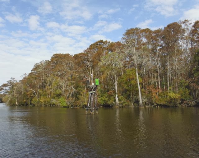
Back on the move into South Carolina
11/4/13.
 |
| Three B's of a good stay: Barney, Beach, Barbecue |
 |
| Barney and Sam with us on Luna |
Back on Luna yesterday afternoon, we met new dock mates, Jim and Bonnie on their Morgan 38, Dana. They are traveling south from Long Island, and this is the second time they've made the trip. They invited us over for cocktails (bring your own) to tell us about their first trip to the Bahamas. Interestingly, they've followed the same route as we have: Dismal Swamp to Elizabeth City, to Manteo, to Ocracoke to Oriental.
Conversation turns to when we should leave in the morning. High tide slack current is at 10:30 am, and Jim suggests leaving then for a fast ride down the Cape Fear River on the building outgoing current. On the other hand, the commander reads in the guidebook that if you leave Carolina Beach at high tide, you will have a swift current coming at you when you get down to Southport and turn away from the Cape Fear inlet. If there is an opposing wind the waves can be quite steep. We discuss this and decide to leave at 9 am, missing some of the benefit of the current, but avoiding the largest waves in Southport.
The cruising guides warn strongly to avoid being influenced by others who seem to know more than you and induce you to go out in conditions your gut tells you are wrong. The discussion among the four of us about when to leave bears some of this flavor, but in the end, we reach a compromise acceptable to all, and as it turned out, we made exactly the right decision.
We're up early and get ready to leave at 9. First, Luna's engine has been running a little hotter than normal, so I spent some time cleaning out the water intake strainer. The antifreeze level was a little low, so I topped that off. We started off, and before we got out of the harbor, the engine temperature started to climb quickly. There is no cooling water circulating through the engine, none coming out of the exhaust. It was working fine when I tested it earlier. Luckily, we can unfurl the jib and turn off the engine while I check it out. Most likely, the water pump lost its prime and there is air in the line. I disconnected the line, sucked some seawater through it and reconnected it. The diesel ran just fine after that and much cooler than the past few days.
The strong north wind against the jib helps push us southward. We're making 6-7 knots, and although the river is quite choppy, we have no trouble navigating the current. We pass a restricted area. It belongs to the military and there is a patrol boat waiting to push anyone aside who enters the restricted channel. It turns out this is the place where nuclear weapons are loaded onto ships. I wonder if this is the Sound of Freedom. The nautical chart calls it the Shoal of Midnight. We stay well within the main channel and out of trouble.
In Southport, we were able to tie up to the free town dock. Our friends on Dana were anchored in the small harbor. When they arrived, there were two boats rafted together on the dock. As we arrived, the two boats left.
We had the afternoon free to have lunch at Fishy Fishy, a local seafood restaurant right on the harbor.
 |
| Lunch in Southport |
We learned a little local history. Southport figured prominently in the Civil War, as it was an important port for the southern states. Ships laden with cotton and tobacco and other products left the Cape Fear inlet bound for the Bahamas where they picked up military supplies. They returned past Southport on their way back up the Cape Fear River to the major shipping port of Wilmington. As soon as the South seceded from the Union, President LIncoln ordered the blockade of all southern ports. Blockade running became a major industry in Southport, and local pilots who could guide ships in through the maze of dangerous shoals at night became local heroes. One of the biggest houses in town belonged to a river pilot.
Walking back to the boat, we passed three men discussing fishing at the back of a pick up truck. One of them stopped when he saw us. "Do you want to use my truck?" he asked. "You can take my truck if you want to do some shopping. Go out to Walmart if you need to. Sorry I didn't ask you sooner." I keep getting this feeling that somehow we've entered a parallel universe in the world of "Nice." We thanked him and told him we had just come from Carolina Beach and had gotten all we needed there for now.
Later in the afternoon, we returned the favor to the folks on Dana and had them over for happy hour on Luna. We talked about the next day's travel. They are off early and plan to go about 50 miles. We are enjoying the rather relaxed pace and need to stop at a marina first to pump out our holding tank. The commander has charted the next segment down to Charlestown, and tomorrow calls for a 30 mile day to Calabash Creek. The distance seems about right to us.
11/5/13 Southport to Barefoot Marina, North Myrtle Beach, S.C. 38nm.
We were up and off the dock early, tying up next door at the Southport Marina for a pump out at 7am. With the time change, the sun sets early We are trying to be done with traveling by 3pm.
The morning is cool and drizzly. The sweatpants I bought yesterday did not bring the warmer weather. In fact, there was no electrical connection available at the public dock, and we couldn't use the space heater last night. We had a cold night aboard Luna. It was 57 degrees in the cabin this morning.
I didn't sleep well for other reasons. For the first time, we are faced with significant tides. Tidal change in the Southport harbor is over 5 feet. We made our dock lines fast at high tide. After lunch, we returned to Luna to find her several feet lower than we had left her, and our dock lines were taut. Our friends from Dana tied their dinghy to the dinghy dock, and as we walked past we noticed it was resting on the exposed harbor bottom, its outboard propeller buried in the mud.
I loosened the dock lines, but we went to sleep at high tide and low tide was scheduled for 2:30 am. I tried to guess just how much slack I should allow. I slept fitfully, waking at 2:45 am to check the lines. They were tight, but still allowed some slack. Just right, I thought. I finally fell asleep on the rising tide.
We were favored again by a north wind and could unfurl the jib to help our speed. As in Vermont, however, the north wind brings the colder air. Our goal for the day was Calabash Creek, a mile or so downstream from the town of Calabash, N.C. I had been hearing about Calabash style cooking. Calabash calls itself the seafood capital of the world, and their style of cooking involves deep frying very fresh fish and shrimp. I read that the famous entertainer of radio and early television, Jimmy Durante, visited Calabash and impressed by the food, became acquainted with Lucille Coleman, owner of Coleman's Restaurant. His well-known sign off, "And good night, Mrs. Calabash, wherever you are," referred to Lucy. With all that in mind, I thought we should at least put our nose into Calabash.
However, we bypassed Calabash Creek. We were making good time with the north wind and didn't feel like sitting around on anchor in the cool damp weather. We kept the bow pointed south. Or rather west in this area. We passed into South Carolina right at Calabash Creek. We made another 15 miles down to North Myrtle Beach. I put Calabash in my growing mental file under "places to check out on the way back."
Right past a swing bridge, Barefoot Marina is a nice place, fairly inexpensive. There are concrete floating docks. Though this sounds like an oxymoron, they are very solid structures, and we made fast to the face of the dock right on the waterway. There is another set of docks across the waterway in front of a large shopping center. Boats tie up there, too, but there are no shower facilities. There are restaurants, however, and a short walk across the bridge gets us there for happy hour.
As we were leaving for our walk, we passed a group of local residents chatting on the dock. A woman staying aboard with her husband recommended the Flying Fish for happy hour. We were ahead of her on this one. We were halfway down the dock when she hurried back to us. "I should have offered you a ride," she said. "Would you like a lift over to the restaurant?" Looking forward to a walk after a day on the boat, we gratefully declined. She described a short cut for us through the complex out to the bridge.
Another alien from the world of Nice. It occurs to me that this is the polar opposite of the zombie apocalypse. Or any of the other doomsday scenarios the movies and news media try incessantly to instill in our imaginations.
At the Fish, I asked the bartender if they had anything that was Calabash Style. She said, "Honey, this is Myrtle Beach. Everything is cooked Calabash style." We had some fried crab cakes, a shrimp salsa, and for dessert a half dozen Chesapeake Bay oysters. We bought a couple crab cakes from the attached fish market to take back for dinner tomorrow night.
11/6/13 Barefoot Marina to Jericho Creek, off the Waccamaw River 38.5 nm
 |
| View of the Ditch, Barefoot Bridge |
Several of the golf courses had greens placed precariously and in my mind, somewhat sadistically close to the water's edge. It seems like the South Carolinians prefer their golf as they do their politics: straight ahead and keep to the right. Veer to the left even a little, and you'll find yourself in deep water.
Large lawns down to the water's edge and golf courses with their chemical lawn treatments can't be good for water quality, and I thought back to the marshes and empty islands of the other Carolina.
I am happy to report, however, that once past a comfortable commuting distance from Myrtle Beach, the tacky development gave way to woodland, and the ditch became more like the Dismal Swamp on steroids: wider and with more Spanish moss draped on the live oak trees. This has been called one of the most beautiful parts of the ICW. Fall had changed the trees. Compared with New England, the colors were muted. But none the less magic.
 |
| Fall colors are muted but present |
Our goal was an anchorage behind Butler Island, a large island in the river. However, we had a fairly strong tailwind and had sailed much of the way up. We saw that the anchorage was exposed to the northeast wind that had propelled us. As we approached the island, we noticed a small well-protected creek off to starboard. The water looked completely flat. We checked our sources (Skipper Bob's book of Intracoastal anchorages and Active Captain) and found Jericho Creek listed in both. We took an abrupt turn to starboard.
These lowlands are Carolina rice country. Georgetown, the next nearest town, is the home of Carolina
 |
| Quiet anchorage on Jericho Creek |
Aside from a fisherman in a skiff returning somewhere upstream, we saw not another soul. Owls hooted us to sleep.
11/7/13. Jericho Creek to Price Creek, 20 miles north of Charleston, S.C., 48 nm.
The commander woke up and announced, "Hey, this is the first day the butter isn't hard." We keep the butter in a sealed plastic container out on the counter.
Thanks to all the planning we did, or perhaps just to dumb luck, there have been very few surprises so far on the trip. But one thing I did not plan for was all the cold weather. My thought was that once we got down the the Chesapeake, it would be shorts, T shirts, and bathing suits. I packed accordingly. This concept held for the first week or so. But it has been cool ever since. Most of the wind in the past 6 weeks has come from the north, and as in Vermont, this brings colder air. Nights have been in the 40's, and 50's, and daytime temperatures in the 60's and 70's, or less if the sky is cloudy.
I did bring a pair of jeans, a couple wool T shirts and pairs of wool socks, a warm jacket, and a windbreaker. A wool sweater and watch cap, and a pair of windproof fleece gloves. In retrospect, I should have brought a cozy fleece jacket or sweat shirt and pants, a couple more long sleeved T shirts, and some warm slippers. The commander had more foresight, of course. As it is, we're putting on more miles to get further south. We'll catch the cold weather on the way back up, however.
We weighed anchor before 7 am and rejoined the Waccamaw. This gave way to another "ditch," and gradually the low country grasslands and woods became coastal estuaries and small islands, as up in North Carolina. Back to interesting small houses and fishing skiffs along the waterfront. We put on about 50 miles by 4 pm and anchored in Price Creek, which winds to the east to join the ocean. Holding was good on the sandy bottom, so we were confident anchoring despite the tidal current. We could hear the ocean from where we sat.
Faced with a choice of taking the dinghy for a short ride to the beach or sitting in the cockpit to watch the sunset over the grassland, we chose the latter. Later we reviewed the most recent weather forecast. After midnight, there will be 25-30 kt north winds and a six-foot tide. We put out more scope on the anchor line and got ready for a noisy night of halyards slapping on the mast and wind whistling in the rigging. We were securely anchored, protected from the waves and actually managed to get some sleep. Before retiring, we took a moment to step out onto the deck and look at the stars shining brightly in the moonless sky.
11/8/13 Price Creek
We spent another day at Price Creek. Overnight, the wind was howling. Waking up, we found pretty much the same conditions. And the butter was hard. It was cold again last night.
There are small craft warnings in Charleston Harbor. Draw bridges in the Carolinas don't open if the wind is above 25 kts. We felt if we left our secure anchorage, we might not be able to get all the way to Charleston and would anchor in a place that might not be as good as the one we're in. So we are staying.
This is not a tragedy. It's lovely here. We can spend the day reading. We can do some boat projects. We can walk on the beach. Or we can do all three of those. Which is what we did.
I have identified one of the cabin leaks as coming from the bolts holding down the mainsheet traveller that sits on the cabin top. We removed this, cleaned off the bolt holes, and reinstalled it with new bedding compound. I put sealer around the cabin windows.
 |
| Whelks and sand dollars were plentiful |
Back on Luna, the sun was going down, The crescent moon was setting, Venus shone brightly up in the sky next to the moon. The sky was turning all sorts of interesting shades of red, purples, blues, orange, and some yellow. The clouds were afire with the glow of the setting sun. Dolphins were swimming around the boat, chuffing as they surfaced. The seagrass on the shores around the creek caught the glow of the setting sun. We wondered--could it get any better than this! We agreed this is the best anchorage yet.
 |
| Secluded beach at Price Creek inlet |
The wind is abating. Tomorrow we will leave for Charleston.
 |
| Sunset on Price Creek |
No comments:
Post a Comment